
Velvet Realty Group Blog
Central Schertz and FM 78: home types, ZIPs, and commute anchors
Central Schertz runs under ZIP 78154, and roughly three tenths of that delivery area is not the City of Schertz. What kind of house you are looking at, and how old it is, is a parcel record held by a county appraisal district rather than a figure published for the area. The daily trip hangs on FM 78, FM 3009, I-35 and Loop 1604, and two of those are active TxDOT work zones.
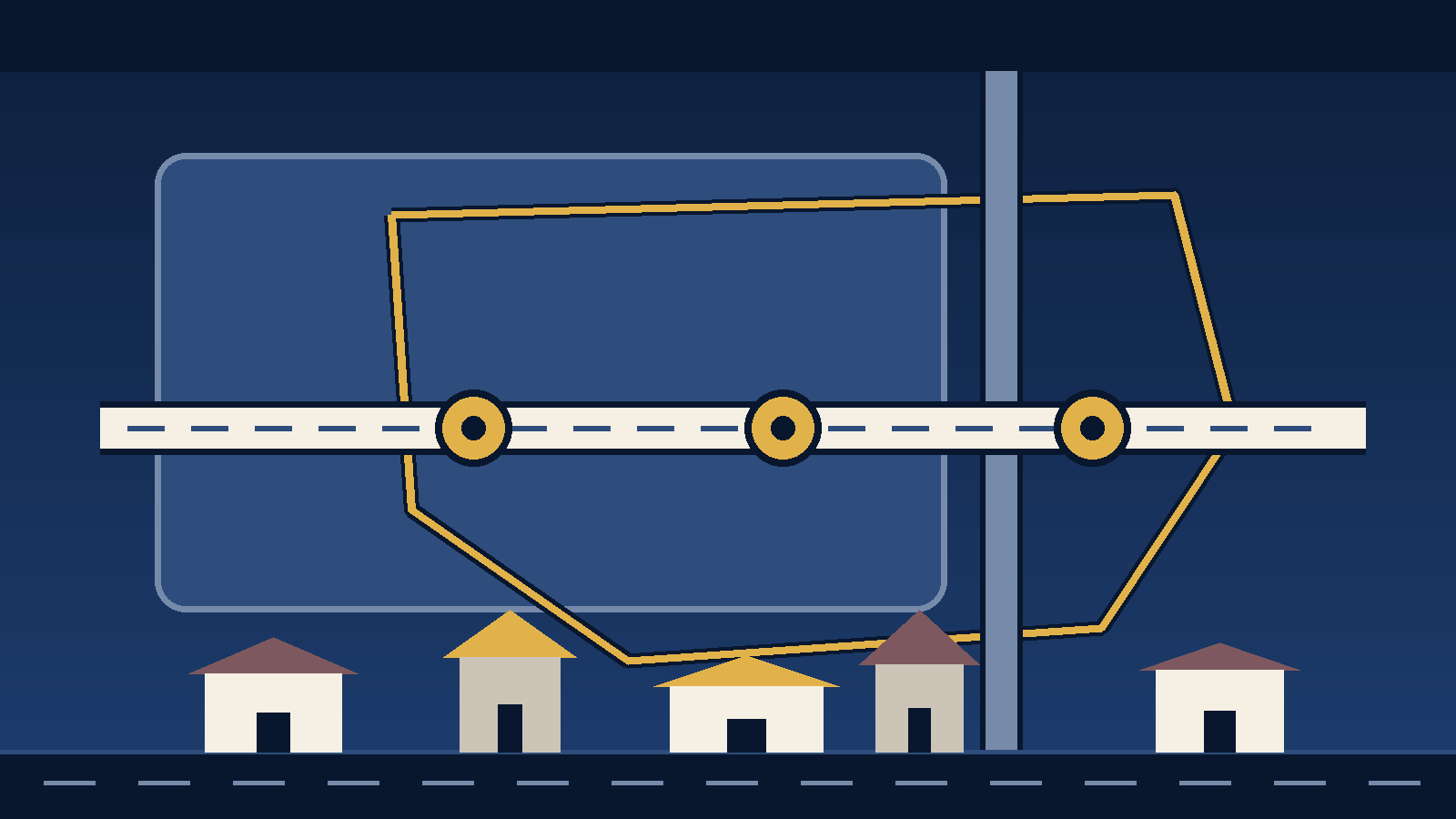
Most central Schertz searches start from a mailing address and a rough sense of where FM 78 runs. That is enough to pick a search filter and not nearly enough to write an offer. The questions that decide the purchase — which city actually taxes the parcel, which county's appraisal district holds its record, what the house is and when it was built, and what the drive looks like at the hour you would really be doing it — are answered by four different offices, and none of them is the ZIP Code.
This page collects what the public record says, names the office that publishes each piece, and dates it. Where a fact belongs to a parcel rather than to an area, it says so and points at the lookup instead of estimating.
What this page covers, and which Schertz page covers the rest
We keep three Schertz pages and they answer different questions, so it is worth saying which one you are on.
The Schertz living guide works at the scale of the whole city: the three counties, the three tax stacks, all five ZIP Codes that cover Schertz land, and the districts. The central Schertz and FM 78 area guide covers the operating detail for this same ground — which agency maintains which road, the four separate utility lookups a single address needs, flood panels, and the city's neighborhood empowerment zones and Main Street incentive programs [13]. This page is the orientation layer between them: what the delivery area actually contains, where a home's type and age are recorded, and the corridors the trip runs on.
All three sit under the Schertz hub, which is where the comparison against the neighboring cities lives.
What is actually inside ZIP 78154
78154 is the ZIP almost everyone means by "Schertz," and it is the right filter to start from: about 71.2 percent of the city's land area sits inside it [1]. The trouble is the other direction, and it is the correction this corridor needs most.
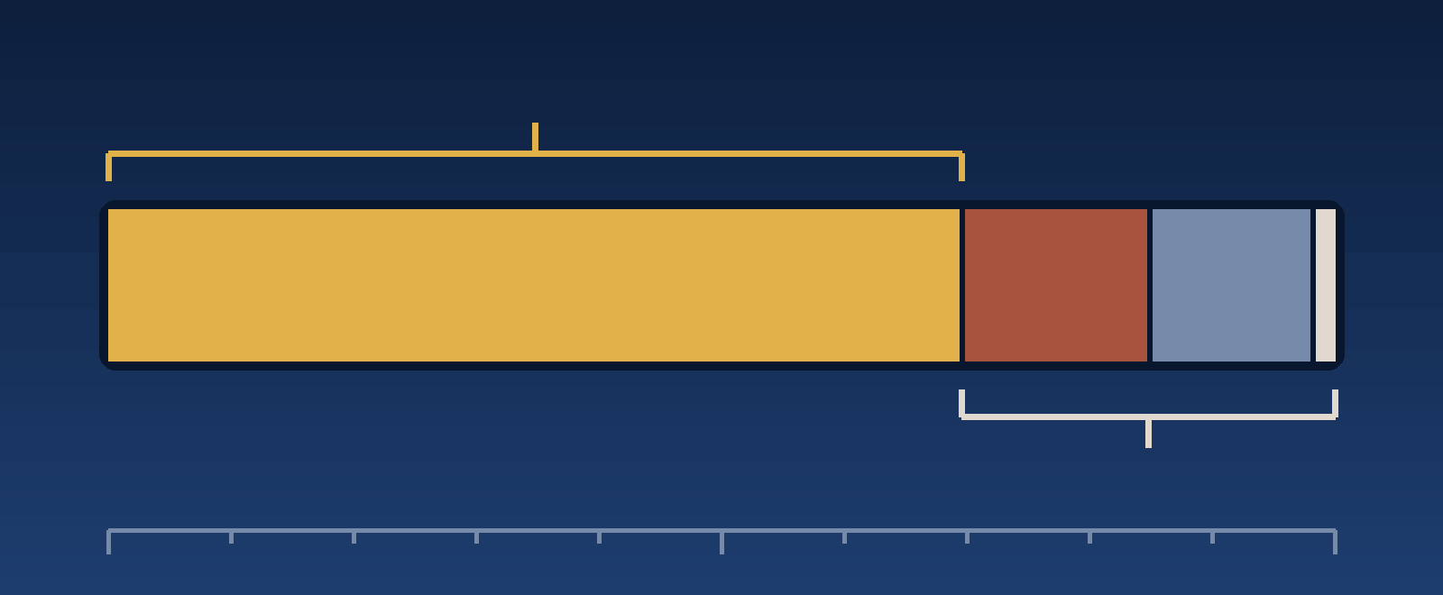
The Census Bureau publishes a file that measures exactly how much land two geographies share, using ZIP Code Tabulation Areas as its approximation of USPS ZIP Codes [1]. Run 78154 through it and the delivery area covers about 32.86 square miles of land, split like this:
| What the land in ZCTA 78154 belongs to | Share of the delivery area |
|---|---|
| City of Schertz | 69.56% |
| City of Selma | 15.33% |
| No incorporated place — unincorporated county land | 13.29% |
| Randolph AFB census designated place | 0.80% |
| City of Garden Ridge | 0.43% |
| City of Cibolo | 0.34% |
| City of San Antonio | 0.19% |
| City of Live Oak | 0.07% |
| City of Universal City | under 0.01% |
Computed from the land-area columns of the U.S. Census Bureau's 2020 ZCTA-to-place relationship file, retrieved September 20, 2026 [1]. ZCTAs approximate USPS ZIP Codes; they are not the ZIP Codes themselves. Shares are of land area and do not describe population, housing, or listings.
So a search filtered to 78154 is showing you eight other jurisdictions alongside Schertz. The two that matter most in volume are Selma, which is a separate city with its own tax rate and its own permit office, and the roughly one eighth of the delivery area that is in no city at all — unincorporated county land, where the municipal services and the municipal rules simply do not apply.
That distinction settles real things: which city taxes the parcel, whose permit counter you stand at before a fence or a roof, whose drought stage governs the sprinkler, and which utility accounts transfer at closing. The area guide works through the utility and road side of that. For the parcel itself, the appraisal record is the document that settles jurisdiction and taxing entities, and it should be read before the offer rather than after.
Where a home's type and age are actually recorded
There is no published statistic describing the typical central Schertz home, and we are not going to manufacture one. What exists is a set of records, each held by a named office, and they answer narrower questions than "what are the homes like here."
For a specific house, the appraisal district holds the record. Property type, year built, improvement detail, taxing entities and exemption status live on the parcel record, not in any area-wide figure. Which district depends on the county line the parcel falls on: central Schertz is generally Guadalupe County [3], while the city also extends into Comal County [4] and Bexar County [5]. The Schertz living guide works through which part of the city sits in which county.
For what may be built on a lot, the city holds the record. The City of Schertz Unified Development Code and the zoning map set the base zoning district for a parcel and what that district permits [6]. A lot's current house and a lot's permitted use are two different questions, and the second one is the one that matters if you are planning an addition, a second structure, or a change of use.
For what is going up now, the city publishes a development map. Schertz maintains a live dashboard of current development activity rather than a static list [7]. Because it is live, anything we printed here would be stale by the time you read it.
The nearest thing to an area-wide housing figure is published by the Schertz Economic Development Corporation for site selectors, and it needs its label read carefully. On September 9, 2026 the EDC's market data page showed, from ESRI, 17,035 housing units citywide: 12,991 owner-occupied, 3,086 rented, and 958 vacant, with an average home value of $379,588 and a 2026 projected population of 44,265 [2]. The EDC's stated 76.2 percent owner-occupancy is computed against all 17,035 units including the vacant ones.
Three things about those numbers. They are vendor model estimates rather than Census counts. They describe the entire City of Schertz, which as the table above shows is not the same footprint as 78154 and is much larger than the central area. And an average home value across a whole city is not a price for any house you are actually considering. If you want a real number, it has to be built from the homes competing with the specific one, in the weeks you are shopping — that is a report we run for an address, and you can ask us for one. Our dated market reporting lives on the market update page.
The corridors the daily trip runs on
Start with the methodology, because it is the part local guides usually skip. We have not run timed drive tests for this page, so there is no minutes figure anywhere on it. Anything we published would be one car, on one day, at one hour, presented as if it were your commute. What follows is the road network and the construction currently sitting on it, sourced and dated. The timing is yours to test.
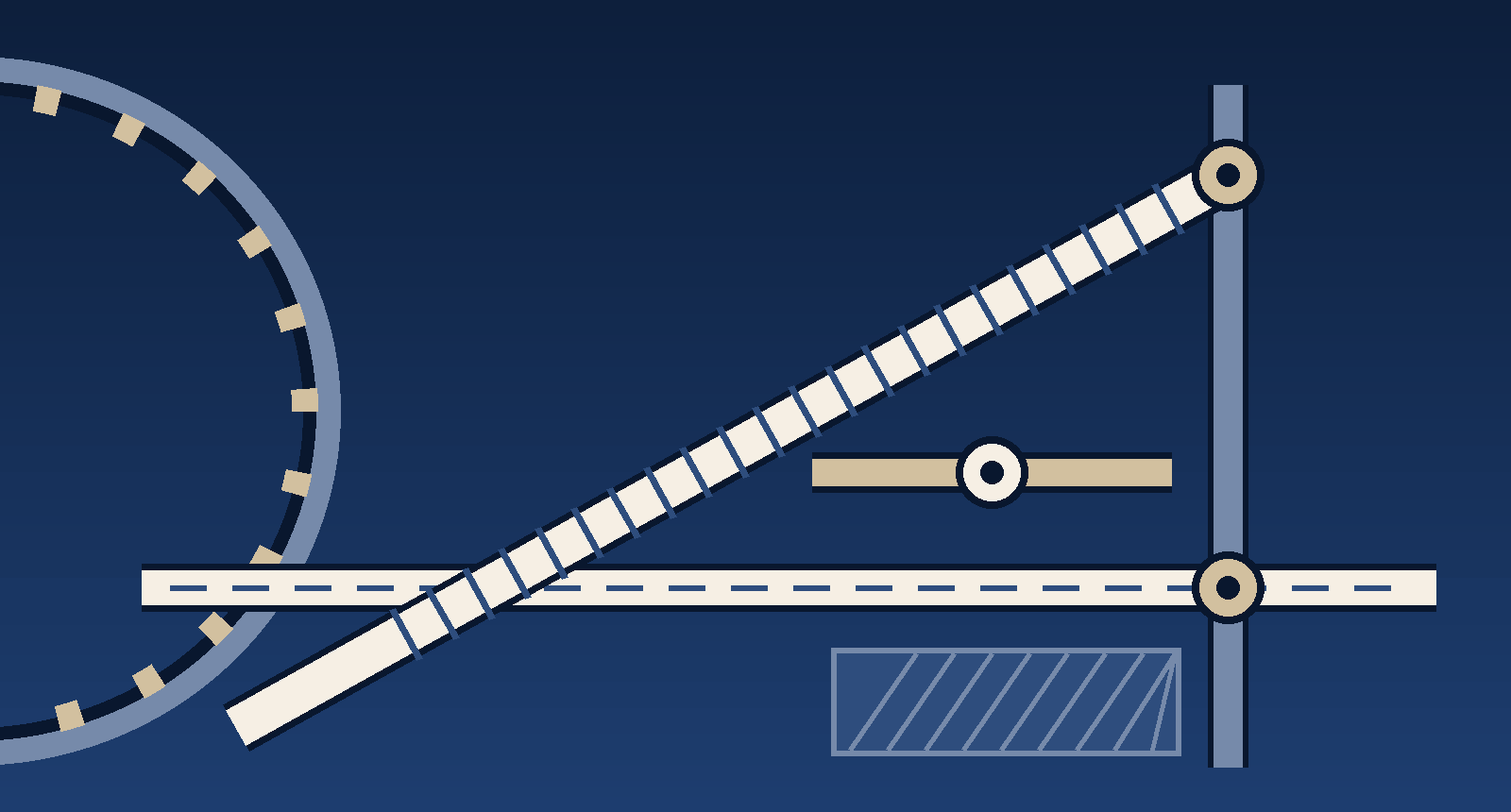
Four anchors carry most of the trip planning in this part of the city, plus the installation that explains a large share of the searches.
- FM 78. The state-maintained east–west route through the corridor, running toward Converse and San Antonio one way and toward Cibolo the other. It is the alternative when the interstate is not working. The city directs FM 78 maintenance reports to TxDOT rather than handling them itself, which the area guide covers in detail.
- FM 3009. The arterial running north from the FM 78 corridor across the city, and the reason the interstate project below matters here specifically: FM 3009 is its northern limit.
- I-35. The interstate connection northeast toward New Braunfels and southwest toward downtown San Antonio, and currently a work zone. TxDOT describes I-35 NEX Central as about 9.5 miles of non-tolled improvements from I-410 North to FM 3009, adding three elevated lanes in each direction — two mainlanes and one HOV lane. Construction began in June 2022, TxDOT lists expected completion in late 2027, and the project runs through northeast San Antonio, Live Oak, Selma and Schertz across Bexar and Guadalupe counties [8].
- Loop 1604. The northern arc toward the medical center and the north side. TxDOT's Loop 1604 North Expansion is a six-segment program with a total estimated cost of $1.579 billion. Segments 1 through 4 are under construction. The two nearest this side are segment 5, Redland to Judson Road, estimated at $169 million with completion estimated in 2028, and segment 6, Judson Road to I-35, estimated at $182 million, with letting anticipated in 2026, construction starting in late 2026, and completion estimated in 2029 [9].
- JBSA-Randolph. The installation sits immediately southwest of this corridor and is why a large share of local searches exist at all. Its footprint is close enough that the Randolph AFB census designated place shows up inside ZCTA 78154 in the table above. Gate choice and gate hours shape the trip more than distance does. Our JBSA-Randolph due-diligence checklist works through the parcel-level version of this.
Two of those are active TxDOT programs with completion dates in 2027, 2028 and 2029. Any trip you time in 2026 is a construction-period trip, and any trip you timed two years ago was a different road. Drive it yourself, from the driveway rather than a map pin, at the hours you would really travel, on more than one day. That is an hour of a weekend and it is worth more than any number we could print here.
The city is redrawing its thoroughfare plan right now
This is the piece with a date on it that is worth acting on. The City of Schertz is updating its Master Thoroughfare Plan, which it describes as "a long-range plan for the City's major transportation network" — planning for future transportation needs, identifying major roadway connections, guiding development decisions, and preserving opportunities for future roadways. The existing plan was adopted in 2017 and is "intended to be updated as conditions change," and the current update includes proposed changes to roadway routes and connections [10].
The city has scheduled a public open house and presentation for Wednesday, September 30, 2026 at 6:00 p.m. at the Schertz Civic Center [10]. If you are buying on or near a corridor in this part of the city, that is the meeting where proposed connections get shown and comments get taken.
The city is also explicit about what the plan does not do, and it is worth repeating because it is the part people misread. Schertz states that the plan does not guarantee immediate construction, does not establish specific construction dates, does not determine exact roadway locations, and does not replace the engineering and funding processes required to actually build a road [10]. A line on a thoroughfare plan is a planning intention, not a scheduled project, and it should not be read as either a promise or a threat to a specific property.
How to check a specific address
In this order, because each answer changes which question comes next.
- Pull the parcel record. Guadalupe, Comal or Bexar, depending on the county [3] [4] [5]. This gives you the taxing entities, the jurisdiction, the property type, the year built and the exemption status, and it is the document that settles whether the home is in the City of Schertz at all.
- Confirm the zoning. Ask the City of Schertz for the base zoning district and what the Unified Development Code permits there, especially if you are planning anything beyond moving in [6].
- Confirm the school assignment with the district. The Texas Education Agency publishes a district locator and states plainly that it is for informational purposes only, that it was not prepared for legal or engineering purposes, that positions shown are approximations, and that users should contact the district with boundary questions [11]. Use it to find the district, then get the current assignment for the exact address in writing from the district itself [12]. A listing remark, a portal widget, and a neighbor's recollection are all downstream of the district and none of them binds it.
- Run the operating checks. Road maintenance responsibility, the four separate utility lookups, and the flood panel all change by address; the central Schertz and FM 78 area guide is the page for those.
- Drive the corridor. At your hours, from the driveway, more than once, knowing two of the anchors are work zones.
What this guide does not tell you
It does not give you a price band for central Schertz, a drive time, an appreciation forecast, or any characterization of who lives in any part of the city. The first two are things we would have to invent to publish. The third nobody can honestly promise. The fourth is not ours to write, and steering a buyer toward or away from an area on that basis is exactly what fair housing law exists to prevent. Where a claim could not be tied to a public record with a date on it, it is not on this page.
Sources
Every source below was retrieved on September 20, 2026 and was live on that date. Each link is the office that publishes the record. Boundaries, vendor estimates, construction schedules, zoning, tax rolls and school assignments all change without notice.
- [1] U.S. Census Bureau, 2020 ZCTA to Place relationship file — the shared land-area measurements behind every percentage on this page. ZCTAs approximate USPS ZIP Codes; they are not the ZIP Codes themselves.
- [2] Schertz Economic Development Corporation, market data — the citywide housing unit, tenure, average value and projected population figures, attributed by the EDC to ESRI and dated September 9, 2026. Vendor model estimates, not Census counts.
- [3] Guadalupe Appraisal District — the parcel record for the Guadalupe County side, including property type, year built, taxing entities and exemption status.
- [4] Comal Appraisal District — the parcel record for the Comal County side of the city.
- [5] Bexar Central Appraisal District — the parcel record for the Bexar County side of the city.
- [6] City of Schertz, Unified Development Code — the code that sets base zoning districts and what each permits. The city's link resolves to the hosted code library.
- [7] City of Schertz, What's Developing in Schertz — the city's live development activity dashboard, which is why no snapshot of it is printed here.
- [8] TxDOT, I-35 NEX Central — project limits from I-410 North to FM 3009, the 9.5-mile length, the elevated-lane configuration, the June 2022 start and the late 2027 expected completion.
- [9] TxDOT, Loop 1604 North Expansion project segments — segment limits, estimated costs, status and estimated completion years, including segments 5 and 6 and the $1.579 billion program total.
- [10] City of Schertz, Master Thoroughfare Plan — the city's description of the plan, the 2017 adoption, the update in progress, the September 30, 2026 open house, and the city's own statement of what the plan does not do.
- [11] Texas Education Agency, School District Locator — the district lookup and TEA's statement that it is informational and approximate and no substitute for asking the district.
- [12] Schertz-Cibolo-Universal City ISD — the district serving most central Schertz addresses, and the office that confirms a current assignment.
- [13] City of Schertz, Main Street Incentive Programs — the Preservation Incentive Program and the Local Flavor program, covered in depth in the area guide.
Questions people ask us about central Schertz
What ZIP code is central Schertz, Texas?
Central Schertz is ZIP 78154, but that delivery area is not the same shape as the city. In the Census Bureau's 2020 ZCTA-to-place relationship file, about 69.6 percent of ZCTA 78154's land area sits inside the City of Schertz. About 15.3 percent is the City of Selma, about 13.3 percent is in no incorporated place at all, and the remainder is split among Randolph AFB, Garden Ridge, Cibolo, San Antonio, Live Oak and Universal City. ZCTAs approximate USPS ZIP Codes rather than reproducing them, so confirm the mailing ZIP for a specific address with USPS and confirm the taxing city from the appraisal record.
Does a Schertz mailing address mean the home is inside the City of Schertz?
No. A ZIP Code is a mail-delivery route and a city limit is a jurisdiction, and in this corridor they do not line up. Roughly three tenths of ZCTA 78154's land area lies outside the City of Schertz. That decides which city taxes the parcel, which permit office you call, and which utility accounts you transfer at closing. The appraisal district record for the parcel settles jurisdiction and taxing entities; the mailing address does not.
What kinds of homes are in central Schertz?
There is no published statistic that describes a typical central Schertz home, and this page does not invent one. Home type, year built and improvement detail are recorded per parcel by the appraisal district for the county the parcel sits in, which in central Schertz is usually Guadalupe. What may be built on a given lot is set by the City of Schertz Unified Development Code and the zoning map. The Schertz Economic Development Corporation publishes citywide ESRI estimates for site selectors, which on September 9, 2026 showed 17,035 housing units citywide, 12,991 of them owner-occupied. Those are vendor model estimates for the whole city, not Census counts and not a description of the central area.
What road construction affects central Schertz right now?
Two TxDOT programs. I-35 NEX Central is about 9.5 miles of non-tolled improvements from I-410 North to FM 3009, adding three elevated lanes in each direction; construction began in June 2022 and TxDOT lists expected completion in late 2027. Its northern limit, FM 3009, is the arterial through Schertz. On the Loop 1604 North Expansion, TxDOT lists segments 1 through 4 under construction, segment 5 from Redland to Judson Road estimated complete in 2028, and segment 6 from Judson Road to I-35 estimated complete in 2029. Any trip timed today is a construction-period trip.
Keep going
Build a Schertz shortlist around a real address
Tell us the streets you are watching and roughly when you need to be in. We will confirm the jurisdiction and taxing entities from the appraisal record, pull the current district assignment from the district itself, and build the comparison from the homes actually competing with the ones you are considering — instead of a citywide figure that fits nobody.