
Schertz Service Area · Area Guide
Central Schertz and FM 78: roads, utilities, and flood maps
The road through central Schertz is a state highway the city does not maintain. The four utilities behind the houses along it come from four different organizations, and which one serves an address changes with position on the same street.
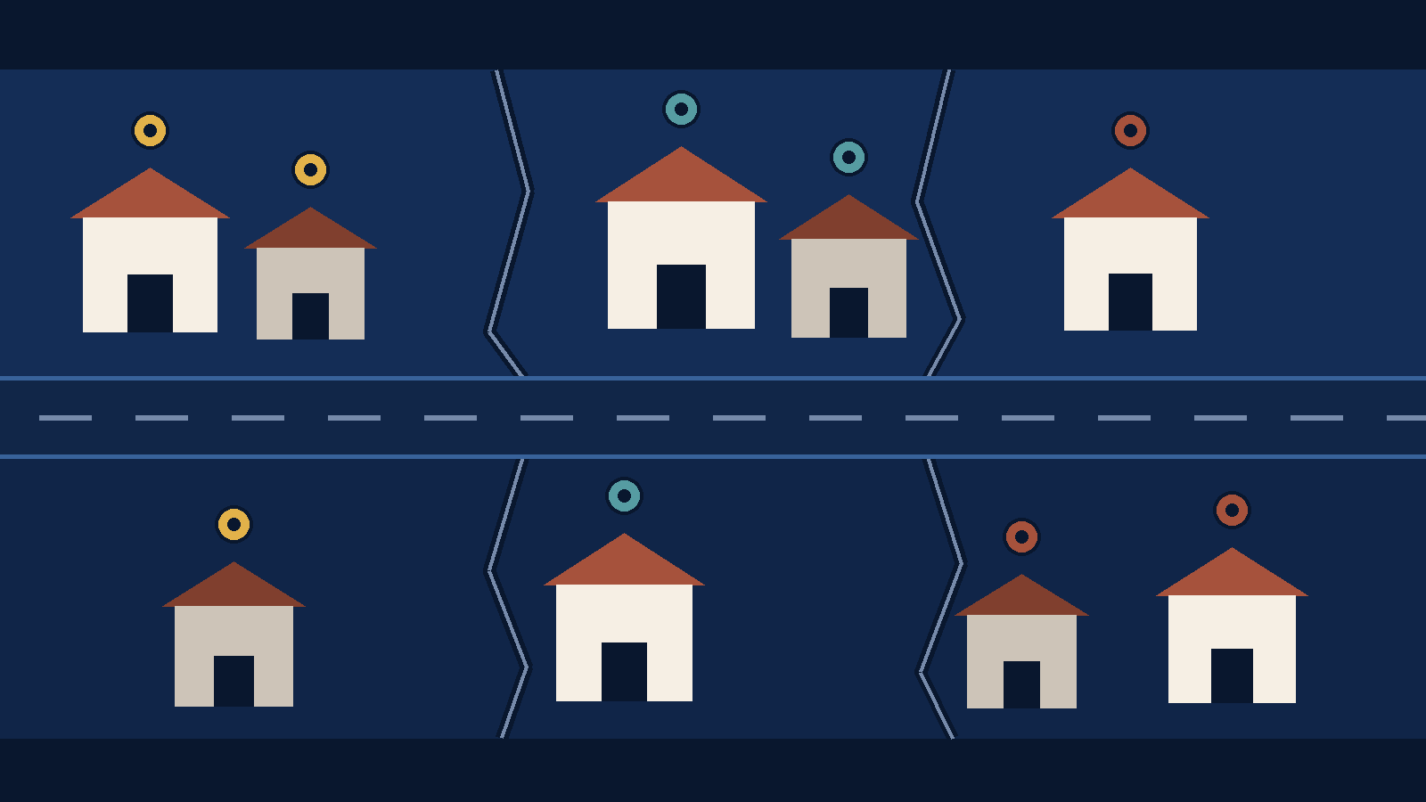
The short version. Central Schertz sits on FM 78, and the City of Schertz runs less of it than most people assume. TxDOT maintains the road. Electricity, water, wastewater, and gas each come from a different organization, and the split changes with position. This page names where the city publishes each answer.
Central Schertz is an orientation area, not an official district. Nobody at the city will confirm that a house is or is not in it, because the city does not draw that line. What the city does draw are the lines that matter: which roads it maintains, which utility serves which part of town, which parcels sit on a flood map panel, and which of its three empowerment zones a property falls in. Those are the questions this page collects.
Everything below was read from its publisher on 2026-08-30. Where an answer is address-specific rather than area-wide, the page says so and points at the office that holds the record instead of guessing.
The roads here belong to TxDOT
The City of Schertz names five routes on its own TxDOT projects page: I-35, FM 3009, FM 78, FM 1518, and I-10. It states plainly that it does not maintain these roads, and asks residents to report potholes, signal outages, damaged guard rails, and debris to TxDOT directly rather than to the city.1
That is worth knowing before you buy on or near one of them. For a question about work or an incident on one of these routes, TxDOT's published project pages and its current contacts are where the answer sits, not the city's complaint line. If your question is address-specific — access, a driveway, a permit — take it to the responsible agency for that location and confirm the answer there rather than assuming which office holds it.
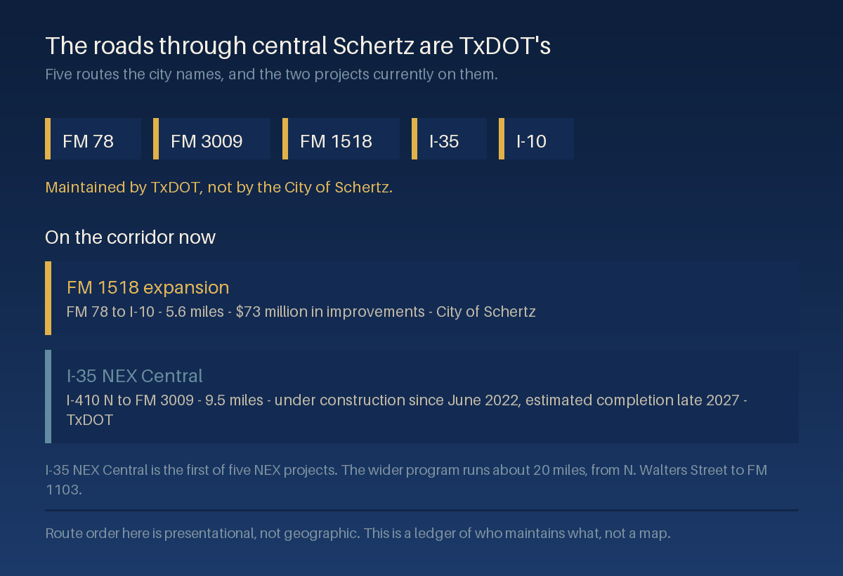
Two projects are on the corridor now.
FM 1518. The city describes TxDOT expanding FM 1518 from FM 78 to I-10 in Bexar County, with $73 million of transportation improvements along 5.6 miles of the corridor.1 TxDOT's own project page adds the shape of it: two 11-foot lanes in each direction, a 34-foot raised center median, a 10-foot shared-use path on the east side and a 6-foot sidewalk on the west. TxDOT states the work is built in phases beginning in spring 2024 and is expected to be completed in 2028, with daytime lane closures generally between 9 a.m. and 4 p.m.3
I-35 NEX Central. Read the two publishers carefully here, because they are describing different things. The City of Schertz page says TxDOT is expanding approximately 20 miles of I-35 from N. Walters Street to FM 1103 across Bexar, Comal, and Guadalupe counties, and then says the I-35 NEX Central project is the first of five NEX projects and has been under construction since June 2022.1 The roughly 20 miles is the program. TxDOT scopes the Central project itself at 9.5 miles of non-tolled improvements with limits of I-35 from I-410 N to FM 3009, a $1.5 billion design-build contract, construction started June 2022, and an estimated completion of late 2027.2 So if you are timing a Schertz commute against a finish date, the Central project's late-2027 date is the one that covers the stretch through Schertz, and the rest of the program runs on its own schedule.
Either way, any drive you time in central Schertz today is a construction-period drive. Test it in your own peak hour, in both directions, and expect the answer to move before the projects close out.
One address, four separate utility lookups
The city publishes its utility splits on the economic development side of the site, and it opens with a caveat that belongs on every line: some utilities depend on the location of your property, and the geographic locations listed under each utility are rough estimations.4
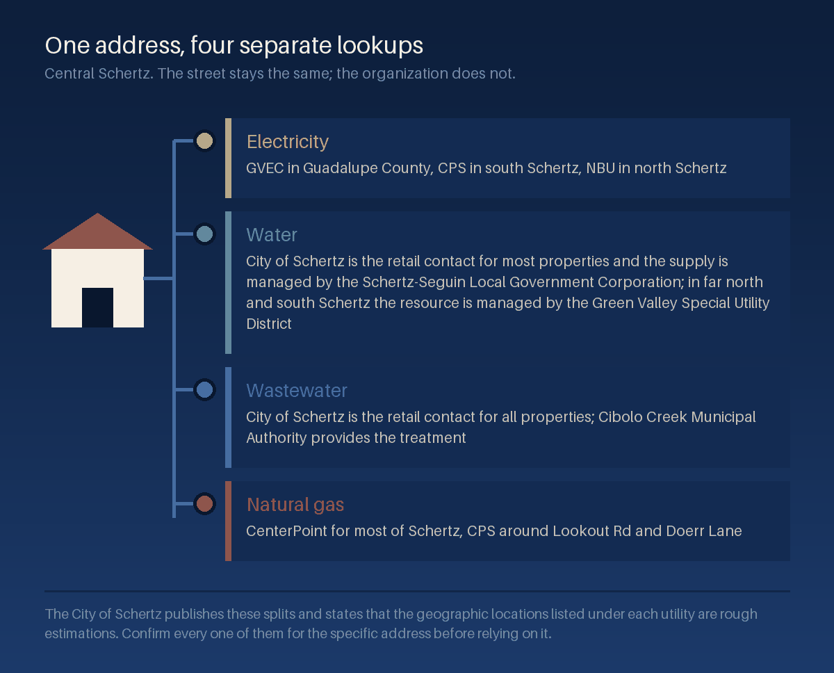
| Service | Area as the city labels it | Provider |
|---|---|---|
| Electricity | Guadalupe County | GVEC |
| South Schertz | CPS | |
| North Schertz | NBU | |
| Water | Majority of city properties | City of Schertz is the retail point of contact; the water resource is managed by the Schertz-Seguin Local Government Corporation |
| Far north and south Schertz | The water resource is managed by the Green Valley Special Utility District | |
| Wastewater | All properties | City of Schertz is the retail point of contact; Cibolo Creek Municipal Authority provides the treatment |
| Natural gas | Majority of Schertz properties | CenterPoint |
| Lookout Rd/Doerr Lane | CPS |
Two houses a few blocks apart can be on different electric providers, and the seller will usually tell you theirs rather than yours. Ask for a recent bill from the actual property, then confirm the account with the provider named on it before you assume the cost carries over.
For telecommunications the city names Charter Spectrum and AT&T, says many sites in the community are served by both for redundancy, and describes Schertz as part of a San Antonio area fiber network of more than 10,000 fiber sheath miles and more than 700,000 fiber strand miles.4 That is a community-level statement and not a promise about any street, so confirm service at the exact address with the provider.
The water here is Carrizo, not Edwards
The City of Schertz states that it has received its water from the Carrizo Aquifer since March 2003, through its partnership with Seguin in the Schertz-Seguin Local Government Corporation, and that unlike other cities in the area that rely on the Edwards Aquifer, Schertz customers have high quality water with limited use restrictions.5 The Texas Commission on Environmental Quality requires the city to publish an annual drinking water quality report, and the city posts them back to 2006.5
The supply itself sits well outside the city. Schertz and Seguin formed that corporation in December 1998, and it draws groundwater from the Carrizo-Wilcox Aquifer in northwest Gonzales County, through twelve wells and a thirty-five million gallon per day treatment facility.6 So the aquifer name a buyer hears in Schertz is shorthand for water produced in another county and piped in.
That sentence is about the supply, though, and it is easy to read it as permission. The yard rule is stricter than it sounds. The city's conservation page states that year-round outdoor sprinkler watering is prohibited between 10 a.m. to 8 p.m. daily, and exempts a handheld hose, another handheld watering device, or a drip irrigation system, any of which may be used at any time.7 The limit is on the sprinkler and the hour rather than on watering itself: set the controller to run outside that window, and hand-water when you want. The same page separately offers water-saving suggestions and a fixture rebate aimed at replacing toilets that exceed 1.6 gallon capacity.7
What the Carrizo supply changes is the drought layer above that rule, not the rule itself. Cities drawing on the Edwards Aquifer publish stages that tighten as the aquifer drops. Schertz still runs a conservation program, and a dry summer can add to what already stands, so read the page before you rely on any of it.
Flood status is a panel question, then a parcel question
Schertz participates in the National Flood Insurance Program. The city records a FEMA Letter of Final Determination dated May 2, 2007 establishing that its Flood Insurance Study report and Digital Flood Insurance Rate Map would take effect on November 2, 2007, and it lists the panel numbers those maps cover: fourteen map panels plus one index sheet for each of the three counties, so seventeen entries in all. Four map panels and an index sheet on the Bexar side, three and an index sheet on the Comal side, and seven and an index sheet on the Guadalupe side.8
That count is the useful part. A city whose flood mapping spans three counties and seventeen sheets is a city where flood status cannot be read off a neighborhood name. The city links an interactive map for looking at the flood plain, and the panel and zone in effect for a specific parcel are an input that a lender and an insurer each review, with each applying its own requirements and underwriting.9
We do not state any property's flood status on this page, and no page can. Pull the parcel on the city's map, confirm the panel and the zone, and take both to your lender and an insurance agent during the option period to work through what they mean for the file.
Two of the city's three empowerment zones are named for this area
The City of Schertz has created three Neighborhood Empowerment Zones under section 378 of the Texas Local Government Code. The city lists the statutory purposes as creating affordable housing, including manufactured housing, in the zone; increasing economic development in the zone; increasing the quality of social services, education, or public safety provided to residents of the zone; and rehabilitating affordable housing in the zone.10
Two of the three are named for the ground this guide covers: the Main Street Neighborhood Empowerment Zone and the FM 78 Neighborhood Empowerment Zone. The city's zone page names those two and links a published map for each.10 It does not print the street limits in text, and neither do we. If you want to know whether a specific property sits inside one, open the boundary map the city publishes for that zone and check the parcel against it, or ask Planning and Community Development, which is the department that administers them.10
Alongside the zones, the city runs Main Street incentive programs. Under the Preservation Incentive Program, matching funds up to $20,000 per property are available for the cost of renovations to preserve historic structures in the Main Street area, and the city publishes a funding agreement, an incentive area map, and a landmark property registry setting out eligibility.11 There is also a Local Flavor economic development program aimed at businesses in the same area.11 These are city programs with their own applications and rules, they are not automatic, and nothing about a property's location entitles anyone to them.
What changes with the county side, and where that is covered
Schertz sits in three counties, and the county a parcel lands in sets its tax list, its appraisal district, and its school district. Those change more between the three sides of the city than anything on this page does. We keep that material in one place rather than repeating it here: the Schertz counties, ZIP codes, schools, and taxes guide carries the published rates for all three county sides, the five ZIP areas that cover city land, and the reason a Schertz mailing address is not the same thing as being inside the city limits.
Read the two together. That page tells you what a parcel's county side costs. This page tells you who to call about the road, the pipes, the wires, and the map.
How to check a specific address
| Who maintains the road it fronts | TxDOT, for I-35, FM 3009, FM 78, FM 1518, and I-10. The city publishes the list and the reporting route.1 Anything else in the public right of way is the city's Engineering and Public Works side. |
|---|---|
| Which electric provider serves it | GVEC, CPS, or NBU, depending on the part of town. Confirm with the provider named on a recent bill from the property rather than the area label.4 |
| Who bills water and wastewater | The City of Schertz utility billing office for most properties, with the resource managed by the Schertz-Seguin Local Government Corporation or the Green Valley Special Utility District, and treatment by Cibolo Creek Municipal Authority.4 |
| Which gas provider serves it | CenterPoint for most of Schertz, CPS around Lookout Rd and Doerr Lane.4 Confirm before assuming an all-electric or gas-appliance home carries the cost you expect. |
| Whether it sits in a flood zone | The city's flood plain management page and its interactive map, then the panel number that covers the parcel.8 Your lender and insurer will each read it independently. |
| Whether it sits in an empowerment zone | The published boundary map for the Main Street or FM 78 zone, or Planning and Community Development at the City of Schertz.10 |
| Its county, taxing units, and school district | The appraisal district holding the record, which names the units billing the parcel. The Schertz jurisdiction guide linked above walks through all three county sides. |
What this guide does not do
It does not draw a boundary for central Schertz, because there is not an official one to draw. It does not state any property's flood zone, tax bill, utility provider, or empowerment zone status, because all four are parcel-level facts held by offices other than us. It is not legal, tax, insurance, or engineering advice, and it does not replace the city, the county, TxDOT, the appraisal district, or a licensed inspector.
It also carries no valuation and no forecast. Nothing here says what a home on this corridor is worth, what it will be worth, or what a purchase will return. And it says nothing about any school, any neighborhood, or the people who live in either.
Questions we get about central Schertz
Is central Schertz an official area of the city?
No. It is a way of talking about the older part of town around Main Street and the FM 78 corridor. The city publishes zones, districts, and utility service areas, and none of them is called central Schertz. Use it to orient a search, then verify every specific fact against the parcel.
Who fixes a pothole on FM 78?
TxDOT. The City of Schertz lists FM 78 among five routes it does not maintain and directs reports for potholes, signal outages, guard rails, and debris on them to TxDOT.1
Can I tell my electric provider from my address?
Not reliably. The city's own labels are Guadalupe County for GVEC, south Schertz for CPS, and north Schertz for NBU, and the city calls those geographic locations rough estimations.4 Ask the seller for a recent bill from the property and confirm the account with the provider on it.
Does a Schertz address mean city water?
For most properties the City of Schertz is the retail point of contact and the supply is managed by the Schertz-Seguin Local Government Corporation, but in far north and south Schertz the city says the water resource is managed by the Green Valley Special Utility District.4 Confirm which one bills the specific address.
Are there watering restrictions in Schertz?
Yes. The city prohibits outdoor sprinkler watering from 10 a.m. to 8 p.m. daily, year-round, and that one is not seasonal. A handheld hose, another handheld watering device, or a drip irrigation system may be used at any hour.7 Because the city's supply is Carrizo rather than Edwards it does not publish the moving drought stages some neighbors do, but the sprinkler window stands on its own, and a dry summer can add to it.
How long will the construction last?
TxDOT gives an estimated completion of late 2027 for I-35 NEX Central and 2028 for the FM 1518 expansion.3 Both dates are the agency's estimates and both have moved before.
Related guides
This page sits under the Schertz service area hub, which links the rest of what we publish on the city. For the county, ZIP, school district, and tax side, read living in Schertz. For the relocation view, moving to Schertz in 2026 covers the practical side, and the pre-listing repair checklist for Universal City and Schertz covers preparation if you are selling.
The companion guide one city over runs the same checks on a different corridor: the Universal City core and Pat Booker Road area guide covers compatible use zones near JBSA-Randolph, floodplain and drought rules, and the utilities that change by address there. For taxes generally, our Texas property tax guide explains how the pieces fit together statewide.
Primary sources
Numbered markers in the text above point into this list. Each entry is the publisher's own page, and each was read on the date shown.
- City of Schertz, TxDOT Projects. The five routes the city names, its statement that it does not maintain them, the FM 1518 figures, and the city's description of the I-35 NEX expansion and of NEX Central as the first of five projects under construction since June 2022. Retrieved 2026-08-30.
- TxDOT, I-35 NEX Central. The Central project's own limits of I-410 N to FM 3009, its 9.5 miles of non-tolled improvements, the $1.5 billion design-build cost, the June 2022 construction start, and the estimated completion of late 2027. Retrieved 2026-08-30.
- TxDOT, FM 1518 Expansion. The lane and median dimensions, the shared-use path and sidewalk, the phasing from spring 2024 with completion expected in 2028, and the daytime lane closure hours. Retrieved 2026-08-30.
- City of Schertz, Infrastructure. Every provider and area label in the utility table, the telecommunications and fiber statements, and the city's own caveat that the geographic locations listed under each utility are rough estimations. Retrieved 2026-08-30.
- City of Schertz, Water and Wastewater Utility. The Carrizo Aquifer since March 2003, the contrast the city draws with cities relying on the Edwards Aquifer, the Schertz-Seguin Local Government Corporation partnership, and the annual TCEQ-required water quality reports posted back to 2006. Retrieved 2026-08-30.
- City of Schertz, Our Water Supply. The December 1998 formation of the Schertz/Seguin Local Government Corporation, and its description of the supply as groundwater from the Carrizo-Wilcox Aquifer in northwest Gonzales County drawn through twelve wells and a thirty-five million gallon per day treatment facility. Retrieved 2026-08-30.
- City of Schertz, Water Conservation. The year-round prohibition on outdoor sprinkler watering between 10 a.m. to 8 p.m. daily, the handheld and drip irrigation exemption, and the fixture rebate program for toilets exceeding 1.6 gallon capacity. Retrieved 2026-08-30.
- City of Schertz, Flood Plain Management. The FEMA Letter of Final Determination dated May 2, 2007, the November 2, 2007 effective date, the flood insurance rate map panel numbers counted in this guide, and the city's interactive flood plain viewer. Retrieved 2026-08-30.
- FEMA Flood Map Service Center. The federal source for the effective flood map panel and zone covering a specific address, which is the record a lender and an insurer each read independently. Retrieved 2026-08-30.
- City of Schertz, Neighborhood Empowerment Zones. The three zones, the section 378 authority, the statutory purposes, the two named zones with a published map linked for each, and Planning and Community Development as the administering department. Retrieved 2026-08-30.
- City of Schertz, Main Street Incentive Programs. The Preservation Incentive Program matching funds of up to $20,000 per property, the eligibility documents, and the Local Flavor economic development program. Retrieved 2026-08-30.
Provenance and review
| Sources read on | 2026-08-30. Every figure above was read from the publisher named beside it on that date, not carried over from an earlier draft. |
|---|---|
| Published | 2026-08-31 |
| Last reviewed | 2026-08-31 |
| Next review due | 2026-11-01. TxDOT project dates and city program terms are the volatile items here, and both should be re-read before this page is reused. |
| Corrections | If a figure on this page does not match its source, tell us and we will correct the page, restate the corrected figure, and update the review date above. |
Bring the address, not just the area name
An area guide can tell you that central Schertz has four utility lookups, a state-maintained main road, and seventeen flood map sheets across three counties. It cannot tell you which of each applies to one house. Send us the address and we will pull the parcel record, run the four utility questions and the flood panel against it, and give you the dated answers with the office that published each one.
Get the address-level version of this page.
Tell us the street and we will send the utility providers, the flood panel, the empowerment zone status, and the county side for that parcel, each with the office that publishes it and the date we read it.