
Velvet Realty Group Blog
Selma, TX and the Retama Corridor: Homes, Taxes, Utilities
Selma is a small city on I-35 that sits in three counties. Its Bexar County side, around Retama Parkway and Lookout Road, holds about 2,200 homes, most built since 2000. Here are the county, tax, school district, utility, flood, road and market facts, each with its source and date.
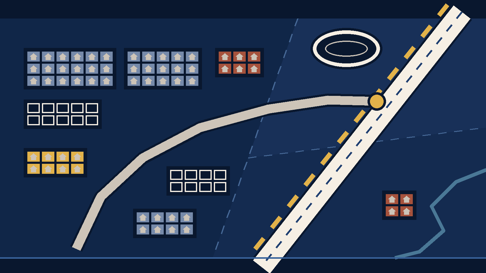
The short version. Selma is a small incorporated city on Interstate 35, about five square miles of land on the northeast edge of the San Antonio area. It sits in three counties: Bexar, Guadalupe and Comal. The Retama corridor in this guide means the Bexar County part of Selma, west of I-35 around Lookout Road and Retama Parkway. That part holds 2,210 homes on the appraisal roll, and most were built from 2000 on. Every one of them is in Judson ISD. The city's Utilities page describes city water, wastewater through Cibolo Creek Municipal Authority and sanitation through Frontier Waste; confirm service by address. A tax bill reflects the rates of the units on its account, which vary by county and account. Check the actual bill and the Bexar County Tax Assessor-Collector rate list. TxDOT is building elevated lanes on I-35 through Selma, with completion estimated for late 2027.
This guide is for a buyer deciding whether Selma belongs on the shortlist. Our Selma area page covers how we compare homes there. This page adds the records: who governs the city, what the homes are like, taxes, schools, utilities, flood maps, road work and the current market. Each fact carries its source and the date we read it, October 17, 2026. Where we could not confirm something, we say so and tell you where to check.
Where Selma is, and whose rules apply
Boundary. Selma is an incorporated city, so its boundary is the city limit. The city says it covers about five square miles in three counties (Bexar, Comal and Guadalupe), and the Census Bureau's current boundary file gives it 5.01 square miles of land. "Retama corridor" is our own label for the Bexar County part of the city. It is an editorial grouping, not a legal area, an MLS area or a subdivision name.
History. The city's history page says Selma grew from a German settlement along Cibolo Creek and a stagecoach stop created in 1849 on the old Austin road, now I-35. Selma incorporated in 1964. Retama Park, the horse racing track, opened in 1995 (City of Selma, History and Quality of Life pages).
City offices and ZIP. City Hall is at 9375 Corporate Drive, Selma, TX 78154, phone (210) 651-6661. The Census geocoder places City Hall in Guadalupe County. ZIP 78154 is used by Selma and Schertz addresses, so a "Schertz" or "Selma" mailing address does not settle which city a house is in. Check the property's account and the city boundary.
Size. The Census Bureau's American Community Survey estimates 11,503 residents and 4,387 housing units in Selma for 2020 to 2024 (5-year estimates, tables B01003 and B25001).
What the homes are like on the Bexar County side
We counted every parcel that carries the City of Selma tax unit (code 35) on Bexar County's parcel layer, which publishes the appraisal district's roll (read October 17, 2026). Of 2,816 parcels, 2,210 are coded as a home (state code A1, a single-family house). The rest include 397 vacant lots, 94 parcels coded as apartment or multifamily property, and 73 commercial parcels. The Guadalupe and Comal County parts of Selma are on other appraisal rolls, which we could not query in the same way, so the counts in this section cover the Bexar side only.
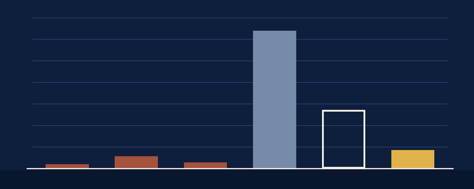
| Period built | Homes |
|---|---|
| Before 1980 | 36 |
| 1980s | 112 |
| 1990s | 54 |
| 2000s | 1,277 |
| 2010s | 543 |
| 2020 to 2024 | 169 |
Nineteen home records have no year built and are not counted. The roll lags construction, so a house finished this year may not appear yet.
- Age: the median home was built in 2006. About 91 percent of the counted homes date from 2000 or later.
- Living area: median 1,988 square feet. Eight in ten fall between 1,578 and 2,695 square feet. The smallest is 480 and the largest 4,478.
- Lot size: median 0.165 acre, about 7,200 square feet. Eight in ten lots fall between 0.131 and 0.287 acre, about 5,700 to 12,500 square feet.
- Stories: 1,231 one-story homes, 829 two-story homes and 126 coded as one and a half stories.
Subdivisions on the Bexar County roll
These are the subdivision names written in the legal descriptions of Bexar-side Selma homes, with the build years on the roll. The list covers only names that appear in those records. It is not a complete list of Selma neighborhoods: 461 Bexar-side homes are outside the subdivisions in this table, and the Guadalupe and Comal parts are not included.
| Subdivision | Homes | Years built on the roll |
|---|---|---|
| Retama Springs | 614 | 2005 to 2014, median 2007 |
| Saturn | 341 | 2000 to 2003, median 2001 |
| Lookout Meadows | 262 | 2001 to 2006, median 2003 |
| Retama West | 225 | 2010 to 2015, median 2012 |
| Creekside Ridge | 92 | 2016 to 2018, median 2017 |
| Sunrise Village | 92 | 2020 to 2023, median 2021 |
| Creekside Gardens | 66 | 2012 to 2016, median 2014 |
| Selma Park Estates | 48 | 1983 to 2024, median 2006 |
| Reserve at Retama Townhomes | 9 | 2010 |
The city's own Neighborhoods page lists twelve subdivisions, including several outside this table: Chelsea Crossing and Forest Creek off I-35, Live Oak Hills off Wiederstein Road, Olympia Hills behind The Forum shopping center, Retama Ridge, and The Trails at Kensington Ranch I and II. It also lists three apartment complexes. We have not documented which county each of those is in, or its housing stock.
Citywide estimate. The Census Bureau's American Community Survey tables B25024, B25003 and B25035 cover all three counties. Of an estimated 4,387 housing units in Selma in 2020 to 2024, about 3,274 were detached single-family homes and about 673 were in buildings with 10 or more units. About 2,700 of the occupied units were owner-occupied and 1,521 were rented. Its estimated median year built for all units is 2010. These survey estimates have margins of error.
For one house, check its account on the Bexar Appraisal District, Guadalupe Appraisal District or Comal Appraisal District site, depending on the county. Appraisal records can differ from a listing.
Property taxes on a Bexar-side Selma home
The Bexar County parcel layer lists CAD and codes 06, 08, 09, 10, 11, 35 and 54 on all 2,210 A1-coded Selma parcels. Code 35 identifies the city and code 54 identifies Judson ISD. Some parcels also carry SL001, whose meaning and financial effect we could not confirm. Check the taxing units and any district assessments on the actual account. A municipal utility district (MUD) or public improvement district (PID) can add a tax or assessment.
| Taxing unit | 2025 rate |
|---|---|
| Bexar County | $0.276331 |
| University Health (Bexar County Hospital District) | $0.276235 |
| Alamo Colleges District | $0.149150 |
| Bexar County Road and Flood | $0.023668 |
The bill is the sum of the rates of the units on the account, which vary by county and account, applied to the relevant taxable values. Check the actual bill and the Bexar County Tax Assessor-Collector rate list before estimating a payment.
The city rate. The county's 2025 PDF lists Selma code 35 with a zero county-collected rate. The city's Current City Tax Rates page lists $0.1891 per $100 without stating a tax year. Ask the city and tax office to reconcile the applicable year and collection method for the account.
The Judson ISD rate. The county's September 30, 2025 list shows $1.0796, the rate put to voters in November 2025. Texas Public Radio reported revised Judson bills after the election. Check the Judson line on the actual bill before you budget.
An unexplained code. 1,095 Bexar-side Selma homes also carry SL001 on the parcel layer, including every home in Retama Springs, Retama West, Creekside Ridge, Sunrise Village and Creekside Gardens. We could not confirm the code's meaning or financial effect. Ask the Bexar County tax office about a specific account, and read the seller's disclosure for any improvement district notice.
Exemptions. The county's 2025 list shows a $20,000 over-65 exemption for Selma and no general homestead exemption, and a $140,000 homestead exemption for Judson ISD. Our property tax calculator runs the arithmetic for a price you enter.
2026 rates. Local units set their 2026 rates in the fall. The table uses the county's 2025 list; check each unit's adopted current-year rate before using it. Homes in the Guadalupe and Comal parts of Selma have different county and school units, so use the bill for the exact address.
School districts
All 2,210 Bexar-side Selma homes carry Judson ISD on the appraisal roll. The city's New Resident page lists three districts for the city as a whole: Judson ISD in Bexar County, Schertz-Cibolo-Universal City ISD in Guadalupe County and Comal ISD in Comal County. The district follows the address, not the city name, so confirm it on the property's tax account and with the district.
For a campus assignment, contact the district for that address. For campus performance data, read the state's Texas School Report Cards. We do not rank schools.
Utilities
- Water, wastewater and trash: the city's Utilities page describes city water, wastewater through Cibolo Creek Municipal Authority and sanitation through Frontier Waste. The city lists an application and supporting documents for new accounts. Confirm service and current account requirements for the specific address with the utility office at (210) 651-7800.
- Electricity: the city lists CPS Energy, GVEC and Reliant Energy. Which one serves a house depends on the address, so ask the seller and confirm with the provider.
- Natural gas: the city lists CPS Energy and CenterPoint.
- Internet: the city lists Spectrum and AT&T. We did not check coverage at any address.
Utility facts come from the City of Selma's New Resident Information and Utilities pages, read October 17, 2026.
Flood map status
Our October 17 screen of Bexar-side home parcels against FEMA's National Flood Hazard Layer found a small number inside mapped Special Flood Hazard Areas (Zones AE and A). The result depends on the parcel-point method and is not a flood determination for any house. Zone AE has a mapped base flood elevation; a lender and insurer can explain how the exact structure's location affects coverage requirements.
We did not screen the Guadalupe or Comal parts. Check the address on FEMA's Flood Map Service Center, read the seller's disclosure, and get an insurance quote during the option period.
Parks and public facilities
The city lists five parks: Davenport Park, FM 1518 Park, Stage Stop Park, John S. Harrison Park and Retama West Park. Stage Stop Park includes the restored stagecoach stop and a visitor center. The city's Community page says Selma residents may use the Schertz Public Library at no cost. The city's Quality of Life page describes racing at Retama Park; check the venue for its current schedule (city pages read October 17, 2026).
Commute anchors and the I-35 work
We have not timed any drive from Selma, so this page gives no commute minutes. These are mapped driving distances from City Hall at 9375 Corporate Drive, using OpenStreetMap road data through the OSRM routing service on October 17, 2026:
| Destination | Route distance |
|---|---|
| Northeast Lakeview College, 1201 Kitty Hawk Road, Universal City | 5.2 miles |
| Brooke Army Medical Center, JBSA-Fort Sam Houston | 12.7 miles |
| San Antonio International Airport | 12.8 miles |
| Comal County Courthouse, downtown New Braunfels | 14.1 miles |
| The Alamo, downtown San Antonio | 17.6 miles |
Distance sources: OSRM routing service with OpenStreetMap road data and the U.S. Census Geocoder. These are routes from City Hall, not travel times.
We did not measure a route to a JBSA-Randolph gate, because the public map data we used does not mark the gates. Our JBSA-Randolph housing page covers the base. A useful test is two drives from the house to your actual destination at your actual start time, once in the morning and once in the afternoon, with the date written down.
Road work. TxDOT's I-35 NEX Central project covers 9.5 miles of I-35 from I-410 North to FM 3009, through northeast San Antonio, Live Oak, Selma and Schertz. It adds three elevated lanes in each direction (two general lanes and one high-occupancy vehicle lane) with direct connections to I-410 North and Loop 1604 West, and it reconfigures entrance and exit ramps along the way. Construction began in June 2022, and TxDOT estimates completion in late 2027 (TxDOT project page, read October 17, 2026). Ramp and lane closures change from week to week, so time a test drive close to your move.
The market: ZIP 78154 in September 2026
For this panel we used the available Realtor.com ZIP 78154 series rather than MLS sales. ZIP 78154 covers addresses in Selma and Schertz, so treat it as a broader area reading rather than a Selma-only figure.
| Measure | Value |
|---|---|
| Median listing price | $350,000 (down 0.9% from September 2025) |
| Active listings | 228 (up 15.2% from a year earlier) |
| New listings in the month | 42 |
| Pending listings | 58 (down 3.4% from a year earlier) |
| Median days on market | 75 |
| Listings with a price reduction reported by the provider | 104 |
| Median listing price per square foot | $164, on a median listing of 2,338 square feet |
In plain terms: the ZIP had more homes for sale than a year earlier at about the same asking prices and slightly fewer pending contracts. For a longer view, the 2024 American Community Survey five-year estimate, table B25077, puts Selma's median owner-reported home value at $313,900. That is an estimate of owner-occupied home value, not a sale price. Our market update tracks the San Antonio area each month. For a sold-price range in Selma, ask us and we will pull closed sales for the streets you are considering.
How to check a Selma address
- County, city, school district and taxing units: the property's account on the appraisal district site for its county, and the current tax bill.
- The SL001 code: the Bexar County tax office, for Bexar-side accounts that carry it.
- Water, sewer and trash: the City of Selma utility office, (210) 651-7800.
- Electricity and gas: the seller's current bills, then the provider.
- School campus: the district that serves the address.
- Flood zone: FEMA's Flood Map Service Center for the address, plus an insurance quote.
- HOA: ask the seller whether a homeowners association covers the house, and if one does, order the resale certificate early in the option period.
- Commute: two timed drives at your real start time, and TxDOT's current I-35 closures.
What we have not documented yet
We have not confirmed these, and we have not guessed: which Selma subdivisions have a homeowners association, and their dues; what the SL001 code on Bexar-side accounts means; home counts, housing stock, tax units and flood status for the Guadalupe and Comal County parts of Selma; which county each subdivision on the city's list is in; a complete list of Selma subdivisions; the electricity provider for a given address; any timed drive, including to JBSA-Randolph; a sold-price range for Selma; adopted 2026 rates for the City of Selma and Judson ISD; and campus assignment for a specific address.
Questions about Selma
What county is Selma, TX in?
Three. Selma is in Bexar, Guadalupe and Comal counties, according to the city. City Hall is in Guadalupe County. The Retama Parkway and Lookout Road subdivisions, including Retama Springs and Retama West, are on the Bexar County roll. The county decides the appraisal district and, with it, much of the tax bill, so check it for each address.
Which school district serves Selma?
It depends on the address. All 2,210 homes on the Bexar side carry Judson ISD on the appraisal roll. The city lists Schertz-Cibolo-Universal City ISD for its Guadalupe County part and Comal ISD for its Comal County part. Confirm the district on the tax account and with the district.
What is the property tax rate in Selma?
It depends on the exact account. The bill is the sum of the rates of its taxing units, which vary by county and account. The county's 2025 rate list and the city's undated current-rate page differ on the Selma city line, and the Judson line changed after the election. Check the actual bill and the Bexar County Tax Assessor-Collector rate list.
Who provides water in Selma?
The city's Utilities page describes city water, wastewater through Cibolo Creek Municipal Authority and sanitation through Frontier Waste. Confirm service for a specific address with the city utility office at (210) 651-7800.
Is Selma in a flood zone?
Our October 17 parcel-point screen of Bexar-side homes against FEMA's National Flood Hazard Layer found a small number inside mapped Special Flood Hazard Areas (Zones AE and A). The result depends on the method and is not a determination for any house. Check the address on FEMA's Flood Map Service Center and get an insurance quote.
Sources
- Bexar County, parcel layer (Bexar Appraisal District roll data). Taxing units, state codes, legal descriptions, year built, living area, lot size and stories for parcels carrying tax unit 35, City of Selma. Read 2026-10-17.
- Bexar County Tax Assessor-Collector, 2025 Tax Rates, run September 30, 2025. Read 2026-10-17.
- City of Selma, Current City Tax Rates, History of Selma, Neighborhoods, New Resident Information, Utilities, Quality of Life and Reinvestment Zone #1 pages. Read 2026-10-17.
- Texas Public Radio, "Revised tax statements headed to Judson, East Central ISD residents", November 7, 2025. Read 2026-10-17.
- U.S. Census Bureau, Geocoder (City Hall and county), and American Community Survey 2020-2024 five-year tables B01003, B25001, B25003, B25024, B25035 and B25077 for Selma. Read 2026-10-17.
- FEMA, National Flood Hazard Layer flood hazard zones. Parcel-point screen read 2026-10-17; check the address with the Flood Map Service Center.
- TxDOT, I-35 NEX Central project page. Read 2026-10-17.
- Realtor.com, Residential listings database, ZIP-level monthly inventory file, September 2026 row for 78154. Downloaded and read 2026-10-17.
- U.S. Census Geocoder and OpenStreetMap road data via the OSRM routing service, for mapped driving distances. Computed 2026-10-17.
Where these figures come from
| Homes, subdivisions, taxing units and school district | Bexar County's parcel layer of appraisal-district roll data, filtered to parcels carrying tax unit 35 (City of Selma). Counts, medians and ranges are our arithmetic from the saved extract, which excludes owner names and street addresses. Guadalupe and Comal County parcels are not included. |
|---|---|
| Flood | A parcel-point screen using an average of parcel-boundary vertices against FEMA's mapped Special Flood Hazard Areas. The point method affects results; this is not a determination for any house. |
| Housing units and value estimates | American Community Survey 2020-2024 5-year estimates for Selma city (all three counties), with their margins of error. |
| Market | Realtor.com ZIP 78154, September 2026, active listings. No closed-sale data is used. |
| Published | 2026-10-18 |
| Data through | 2026-09-30 for market figures. All sources read 2026-10-17 unless noted. |
| Next review due | 2026-11-17 for the market panel and road work. 2026-12-15 for 2026 tax rates and the SL001 code. 2027-04-17 for utility, flood and park facts. |
| Corrections | If a figure on this page does not match its source, tell us and we will correct it and update the review date. |
Related guides
This page adds records to our Selma area page, part of our service areas. Nearby cities have their own guides: Live Oak at I-35 and Loop 1604, Universal City, central Schertz and Schertz. If you are arriving on orders, start with the military relocation page. Our buyer page explains how we work with buyers.
Ask for a Selma shortlist
Send us your budget and the parts of Selma you like. We will match current listings and include the county, school district, taxing units and flood map for each one, with the date we read each.
Velvet Realty Group is brokered by LPT Realty, LLC. Equal Housing Opportunity.
Compare Selma homes with the records already pulled.
Send us your budget and the streets you like. We will match current listings and include the county, school district, taxing units and flood map for each one.