
Velvet Realty Group Blog
Downtown Cibolo and the FM 78 Corridor: Homes, Market Data, and Roads
Downtown Cibolo is small. About 135 homes sit in a city of roughly 11,650, and it is the one part of town where older houses are common. A third of its area is in the 100-year floodplain, the railroad splits it in two, and TxDOT now expects the FM 1103 widening north of downtown to finish in Fall 2029.
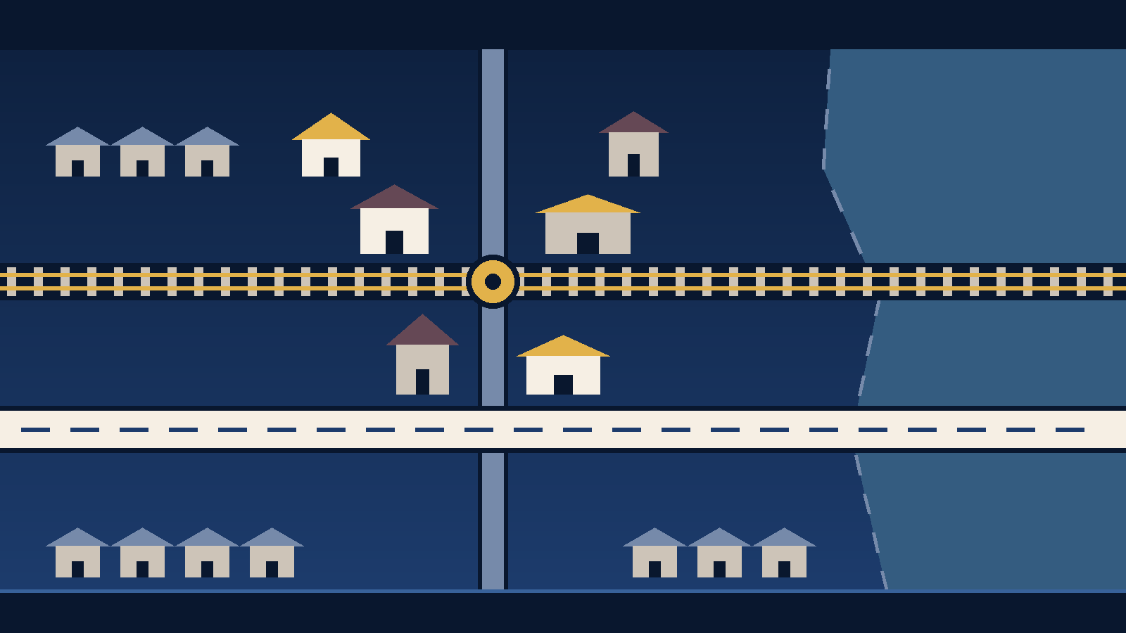
The short version. "Downtown Cibolo" usually means Old Town, the older district around Main Street between FM 78 and Loop 539. The city counts about 135 homes there. At least a third of its buildings went up before 1970. Across the whole city, only about 1.5% of homes are that old, by Census estimates. Old Town also has real drawbacks. About 34% of it is in the 100-year floodplain. The Union Pacific tracks cut through the middle. TxDOT now expects the FM 1103 widening north of downtown, on the main road in from the north, to finish in Fall 2029.
Most Cibolo housing is recent and detached. Downtown is the exception. That makes it the part of town where a buyer is most likely to find an older house, a larger lot on Main Street, or a house next door to a business. It is also where the questions about flooding, street width and the future district boundary matter most. This guide uses the city's own October 2025 study of Old Town, the Census Bureau's newest housing estimates, and August 2026 market data. Each figure is dated where it appears.
Which Cibolo page answers what
We have three Cibolo pages, and each answers a different question. The Cibolo living guide covers ZIP codes, city limits, the school district and the tax rates. The downtown Cibolo and FM 78 area guide covers utilities. It explains which water district serves an address, who bills sewer, the drainage and trash fees, and the irrigation rules. This page covers the houses, the market, and the roads and drainage that shape daily life downtown. All three sit under the Cibolo service area hub.
Where Old Town begins and ends
The city's own description is the closest thing to a boundary. It says Old Town was originally the area bounded by FM 78 to the south, the railroad tracks north to Main Street and Buffalo Trail, then northeast along Buffalo Trail to East Loop 539. The city says that area holds about 188 lots and became the Old Town Mixed Use Overlay District in 2010. An overlay district is a zoning layer with its own extra rules on top of the base zoning. The city also says the boundary has since been drawn differently on its Zoning Map and its Future Land Use Map. Settling that boundary is one of the stated goals of its Old Town Plan (City of Cibolo, Old Town Master Plan project page, read September 29, 2026).
The plan's study area is larger than the overlay, at 260 acres (City of Cibolo, Old Town Plan Existing Conditions Report, October 2025). In this article, "Old Town" means the area the city describes. "Downtown" is the everyday name for the same place, not a separate legal area.
Where the plan stands. The city's project page says the draft plan was tentatively set for an Economic Development Corporation recommendation on May 21, 2026, and for City Council "consideration of adoption" on June 9, 2026. When we read it on September 29, 2026, the page still listed the Share phase as live. It did not say whether Council adopted the plan. We have not confirmed the outcome. If a final boundary or a zoning change would affect a property you are considering, ask the City Secretary for the June 9, 2026 minutes, and ask the Planning Department in writing which overlay applies to the parcel.
What the housing looks like
Two public sources describe Cibolo's housing. They measure different things, and neither describes one particular house.
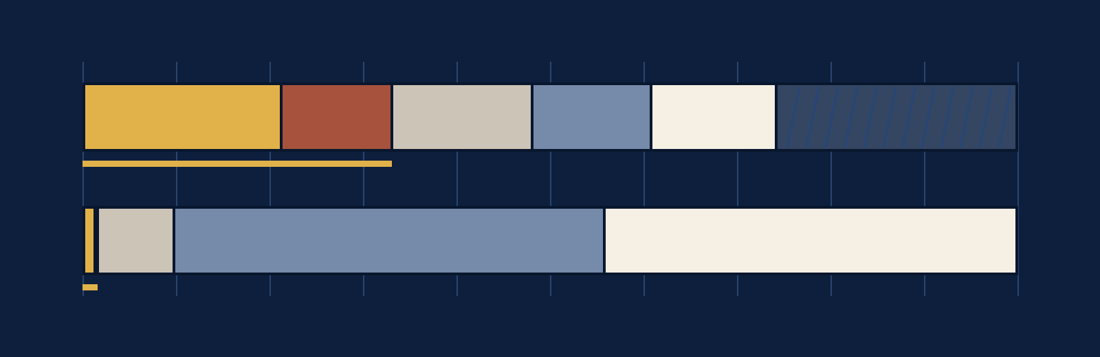
Old Town, from the city's study. The city counts about 135 homes in Old Town and says most are single-unit homes. Its map of building ages shows 21.2% of Old Town's buildings dating from 1950 or earlier. Another 11.8% date from 1950 to 1969, 15% from 1970 to 1989, 12.7% from 1990 to 2009, and 13.4% from 2010 or later. The remaining 25.9% have no recorded year. Those shares count all buildings, including businesses and civic buildings, not only homes. The study also notes that many Old Town businesses now operate in former single-family homes, some with two to four businesses in one house. So on some blocks, the house next door may be a shop or an office (Existing Conditions Report, October 2025, sections 2.1, 2.5 and 2.6).
The whole city, from the Census Bureau. The 2020 to 2024 American Community Survey 5-year estimates put the City of Cibolo at 11,650 housing units, with a margin of error of plus or minus 492. Of those, 10,494 are single-family detached homes, about 90%. Mobile homes account for 496, about 4%. About 5% are in buildings with five or more units. The estimates show essentially no units in two- to four-unit buildings. The median year built is 2008. About 81% of the city's housing units were built in 2000 or later. Only about 180 were built before 1970, with a margin of error near 110 (U.S. Census Bureau, tables B25001, B25024, B25034 and B25035, released January 2026, read September 29, 2026).
| Built | Old Town buildings | All Cibolo housing units |
|---|---|---|
| 1950 and earlier (city: before 1950) | 21.2% | 1.3% (149) |
| 1950 to 1969 | 11.8% | 0.3% (30) |
| 1970 to 1989 | 15.0% | 8.2% (955) |
| 1990 to 2009 | 12.7% | 46.0% (5,356) |
| 2010 and later | 13.4% | 44.3% (5,160) |
| No recorded year | 25.9% | Not applicable |
The two columns count different things, so read them as a contrast, not a match. An older house brings its own checks: the age of its wiring, plumbing and roof, and whether earlier work was permitted. A general home inspection will not always cover all of that.
What is allowed on a lot matters as much as what stands on it today. The study says Old Town has two residential zoning districts. Together they allow at most 5.5 homes per acre without a conditional use permit, a case-by-case approval from the city. It also reports that 32.2% of Old Town's land is vacant and 19.7% is owned by the city (Existing Conditions Report, sections 2.2, 2.5 and 2.6). Because the zoning code is being rewritten, confirm a lot's current rules with the Planning Department before you count on an addition, a second unit or a change of use.
Flooding is the first question downtown
The city's study is direct about this. It says Old Town "faces chronic flooding" because it sits between Town Creek and Cibolo/Dietz Creek, and it puts 34% of Old Town inside the 100-year floodplain. The 100-year floodplain is the area with a 1% chance of flooding in any year. The study describes three problem areas. The downtown core ponds often because the land is flat. Along the south edge, FM 78 acts as a dam and blocks water from draining south. In the northern part of Old Town, shallow roadside ditches leave standing water after heavy rain. Its drainage analysis, dated July 1, 2025, says the Main Street and Schlather intersection "still experiences several feet of submergence during storm events" (Existing Conditions Report, hydrology and drainage pages and appendix).
That does not tell you the flood zone for any one house. A lender and an insurer each check that against FEMA's current map for the address. For a downtown property, pull the FEMA flood map for the parcel early. Ask the seller about past water in the house or garage. Get an insurance quote during the option period, the short window in a Texas contract when a buyer can end the deal for any reason.
What the market showed in August 2026
No public data series covers Old Town alone. With about 135 homes, a month of sales there would be too small to mean much. The closest published figures are for the Cibolo ZIP code and for Guadalupe County. Neither one is downtown, and the living guide explains why ZIP 78108 is not the same as the city.
| Measure | Value | Area and source |
|---|---|---|
| Median listing price | $349,900 (down 3.3% from August 2025) | ZIP 78108, Realtor.com, read September 29, 2026 |
| Active listings | 359 (up 8.8% from a year earlier) | ZIP 78108, Realtor.com |
| New listings in the month | 96 | ZIP 78108, Realtor.com |
| Pending listings | 92 | ZIP 78108, Realtor.com |
| Median days on market | 60 | ZIP 78108, Realtor.com |
| Listings with a price cut | 180, or 34.3% of active listings | ZIP 78108, Realtor.com |
| Median listing price per square foot | $147, on a median listing of 2,398 square feet | ZIP 78108, Realtor.com |
| Closed sales | 356 (down 1.4% from August 2025) | Guadalupe County, Texas A&M Real Estate Research Center, read September 27, 2026 |
| Median sold price | $284,990 (down 3.1%) | Guadalupe County, Texas A&M |
| Months of inventory | 5.70 | Guadalupe County, Texas A&M |
Put simply, the Cibolo ZIP had more homes for sale in August than a year earlier, asking prices were slightly lower, and about a third of listings had a price cut during the month. Months of inventory is how long the current listings would last at the current sales pace. These figures describe August and will change. Our market update tracks the San Antonio area month by month. For a downtown house, the useful comparison is a hand-picked set of recent sales near that address, and we build that for each property.
The roads, the railroad, and what is changing
We have not timed any drives for this page, so it gives no commute minutes. Below are the roads, how they connect, and the construction on them, each with a source and date.
- FM 78 runs along the south edge of Old Town. The city's study calls it the arterial, a major through road, that links Old Town to Schertz, Seguin and Joint Base San Antonio-Randolph, and a targeted growth area for new commercial, residential and industrial building.
- FM 1103 connects the northern part of the city to North Main Street and runs from I-35 down to FM 78. TxDOT is widening the I-35 to Rodeo Way section from two lanes to four with a center turn lane, sidewalks and bike lanes. TxDOT's project page says construction started in November 2022 and is estimated to finish in Fall 2029 (read September 29, 2026). The city's road page, read the same day, still gives the earlier estimate of "late 2025 or early 2026." On September 23, 2026, KSAT reported city officials saying the finish is now 2029, with utility conflicts as the cause of the delay. Plan on 2029.
- I-35 and I-10. The study says neither interstate gives direct access to Old Town, which sits roughly halfway between them. The city's road page says the I-35 NEX Central project, which adds elevated lanes up to FM 1103, is expected to be finished in late 2027. The South Phase 1 project is targeted for late 2028.
- The railroad. The Union Pacific tracks run east-west through the middle of Old Town. The study says they leave a 150-foot gap between restaurants and shops on either side. KSAT reported on September 23, 2026 that city officials expect a railroad overpass at FM 78 and Country Lane, estimated at nearly $70 million and funded by a TxDOT grant, to reduce delays from passing or stalled trains. A TxDOT spokesperson told KSAT the project is still in planning and construction would start in about three years. We have not found a TxDOT project page for it yet.
- Downtown streets. The study measures right-of-way, the full public strip for road, sidewalk and utilities. It is 30 to 40 feet on local streets north of the railroad and about 50 feet south of it, and 50 to 80 feet on the main north-south route. Sidewalks are patchy, and some streets have none. The city is building the Town Creek Trail, about 2 miles of 10-foot hike-and-bike path, to link Old Town with Schlather Park and the Cibolo Sports Complex. The study says 54% of Old Town is within a quarter-mile walk of a park or open space.
If a house fronts FM 1103 between Rodeo Way and FM 78, TxDOT's public meeting notice for that section says the widened road needs 120 to 135 feet of right-of-way. It directs schedule questions to its San Antonio district office. The downtown area guide covers that section in more detail.
How to check a downtown address
- Is it inside the Old Town overlay, and what zoning applies? Ask the City of Cibolo Planning Department in writing. The city says its own maps disagree.
- Did Council adopt the Old Town Plan, and what did it change? Ask the City Secretary for the June 9, 2026 minutes.
- Flood zone and flood history. Check the FEMA flood map for the parcel, the seller's disclosure, and an insurance quote during the option period.
- Year built, lot size and improvements. Look up the parcel on the Guadalupe Appraisal District website.
- Water, sewer and city fees. See the downtown area guide, which names the office for each.
- Road work near the lot. Check TxDOT's FM 1103 project page on the day you need the answer, and the city's road page.
What we have not documented yet
We have not documented the following, and we have not guessed at them. Whether the Old Town Plan was adopted on June 9, 2026, and where its final boundary sits. Drive times from downtown to any destination, because we have not tested them. A sold-price or listing series for Old Town alone. Whether any Old Town property carries HOA dues. Where the planned FM 78 and Country Lane overpass would sit relative to Old Town. We have not listed every subdivision near downtown, and none of this is a complete inventory. It is not legal, tax, insurance or engineering advice, it gives no valuation or forecast, and it says nothing about any school or about the people who live in any part of Cibolo.
Questions about downtown Cibolo
Where is downtown Cibolo?
It is the older district around Main Street that the city calls Old Town. The city's description bounds it by FM 78 to the south, the railroad and Main Street, and Buffalo Trail up to East Loop 539. That area holds about 188 lots and has been a zoning overlay since 2010. The city says its maps show the boundary differently, so confirm any single parcel with the Planning Department.
Are the homes in downtown Cibolo older than the rest of the city?
Yes, by a wide margin. The city's October 2025 study found 33% of Old Town's buildings date from before 1970, and another quarter have no recorded year. Across the whole city, Census estimates put about 1.5% of housing units before 1970, and the median year built is 2008.
Does downtown Cibolo flood?
The city's own study says Old Town faces chronic flooding and puts 34% of it inside the 100-year floodplain. Flood status for one address comes from FEMA's map for that parcel, which the lender and the insurer each check.
When will the FM 1103 construction in Cibolo be finished?
TxDOT's project page estimates Fall 2029 for the I-35 to Rodeo Way widening, which started in November 2022. City officials told KSAT on September 23, 2026 that 2029 is the current expectation, after utility conflicts delayed the work.
Sources
- City of Cibolo, Old Town Plan Existing Conditions Report, October 2025, with the drainage analysis dated July 1, 2025. The source for the study area, the home count, building ages, zoning density, vacant and city-owned land, floodplain share, drainage, rights-of-way, the railroad gap, trails and parks. Downloaded and read 2026-09-29.
- City of Cibolo, Old Town Master Plan project page (linked from cibolotx.gov/OldTown). The original boundary description, the roughly 188 lots, the 2010 overlay, the inconsistent maps, and the adoption schedule. Read 2026-09-29.
- City of Cibolo, Long Range Planning. The Unified Development Code rewrite and the Old Town Master Plan listing. Read 2026-09-29.
- U.S. Census Bureau, American Community Survey 2020-2024 5-year summary file, tables B25001, B25024, B25034 and B25035 for Cibolo city, Texas. Files dated January 29, 2026. Downloaded and read 2026-09-29.
- Realtor.com, Residential listings database, ZIP-level monthly inventory file, August 2026 row for 78108 (file updated September 3, 2026). Downloaded and read 2026-09-29.
- Texas A&M Texas Real Estate Research Center, Housing Activity data, Guadalupe County, August 2026. Read 2026-09-27.
- TxDOT, FM 1103 from I-35 to Rodeo Way. Scope, November 2022 start and Fall 2029 estimate. Read 2026-09-29.
- TxDOT, FM 1103 from Rodeo Way to FM 78. The 120 to 135 foot right-of-way and the district office contact. Read 2026-09-29.
- City of Cibolo, Road Closures. The city's FM 1103 estimate and the I-35 NEX schedule. Read 2026-09-29.
- KSAT, "FM 1103 widening project in Cibolo now expected to finish in 2029", September 23, 2026. City officials on the 2029 date and the utility conflicts, and the FM 78 and Country Lane overpass. Read 2026-09-29.
- FEMA, Flood Map Service Center, for the effective flood map at a specific address.
- Guadalupe Appraisal District, property search, for a parcel's year built, land and improvements.
Where these figures come from
| Old Town housing, land, flooding and streets | City of Cibolo, Old Town Plan Existing Conditions Report, October 2025, sections 1.2 to 2.7 and the July 1, 2025 drainage appendix. Building-age shares are of all buildings, from the report's Figure 15. |
|---|---|
| Citywide housing | ACS 2020-2024 5-year estimates for Cibolo city, Texas (place 4814920). Shares and the pre-1970 total are our arithmetic from the published counts. The margin of error on the pre-1970 total combines the published margins by the Census Bureau's root-sum-of-squares method. |
| Market | Realtor.com ZIP 78108, August 2026 (active listings). Texas A&M Real Estate Research Center, Guadalupe County, August 2026 (closed sales). Listing and sold figures are kept separate. |
| Roads | TxDOT project pages, the City of Cibolo road page, and KSAT's September 23, 2026 report quoting city officials and a TxDOT spokesperson. |
| Published | 2026-09-30 |
| Data through | 2026-08-31 for market figures. Sources read 2026-09-27 to 2026-09-29. |
| Next review due | 2026-10-30 for the market panel. 2026-12-30 for roads, zoning and the Old Town Plan, or sooner if the city publishes an adopted plan. |
| Corrections | If a figure on this page does not match its source, tell us and we will correct it and update the review date. |
Related guides
This page sits under the Cibolo service area hub. For the utilities, fees and irrigation rules on the same ground, read the downtown Cibolo and FM 78 area guide. For ZIP codes, city limits and taxes, read living in Cibolo. One city over, the central Schertz and FM 78 guide covers the neighboring stretch of the same corridor. If you are weighing a newer subdivision house against an older one downtown, new construction in Schertz, Cibolo and New Braunfels covers the builder side. Our buyer page explains how we work with buyers.
Ask for a Cibolo shortlist
Tell us what you want: an older house near Main Street, a newer one in a subdivision, or both side by side. We will send a shortlist of current Cibolo listings. For each one, we will pull the parcel record, flood map and zoning, with the date we read each.
Velvet Realty Group is brokered by LPT Realty, LLC. Equal Housing Opportunity.
Get a Cibolo shortlist with the checks already done.
Send us your budget and what you want in a house. We will match current listings and include the flood map, zoning and parcel details for each one.