
Velvet Realty Group Blog
New Braunfels City Report 2026: Growth, Housing, and the Areas That Feel Different
New Braunfels is not one uniform housing market. This report explains the city's growth, current housing context, and the practical areas inside and outside the Loop 337 and I-35 ring.
New Braunfels is too large and varied to treat as one housing market. A home near Main Plaza, a newer house east of I-35, a Veramendi property west of Loop 337, and an acreage address in 78132 can all appear in the same New Braunfels search. They may have different city-limit status, school districts, utility providers, tax entities, road access, flood considerations, and resale competition.
This city report gives buyers and sellers a practical way to divide New Braunfels before comparing individual neighborhoods. The Loop 337 and I-35 ring is useful for orientation, but it is not a legal neighborhood boundary. City limits, the extraterritorial jurisdiction, county lines, school zones, utility territories, and special districts still have to be checked for the exact property.
For an evergreen comparison of neighborhoods, taxes, utilities, and current projects, use the Velvet Realty Group New Braunfels area guide. This report focuses on the city's 2026 growth and the geographic pockets that will become separate guides in this series.
New Braunfels at a glance
The U.S. Census Bureau estimated 122,492 residents in New Braunfels on July 1, 2025. That was 35.5 percent above the April 2020 population-estimates base of 90,394. The city had 57,740 residents in the 2010 Census, which shows how much its scale has changed in fifteen years.
The same Census profile reports:
- 40,991 households in the 2020 through 2024 American Community Survey period
- a 65.3 percent owner-occupied housing rate
- a $339,400 median value for owner-occupied housing units
- $1,654 median gross rent
- a 27.1-minute mean travel time to work
- 7,504 veterans
Those are citywide Census estimates, not current sale prices or promises about a specific household's costs. They are useful as a baseline. Current homes, taxes, insurance, commute, and utility costs should be compared address by address.
New Braunfels is the Comal County seat, but the city also extends into Guadalupe County. It includes territory in New Braunfels ISD and Comal ISD. A New Braunfels mailing address can also fall outside city limits. That is why the address alone does not answer who provides services or which rules apply.
A practical map: the Loop 337 and I-35 ring
Loop 337 curves around the west and north sides of central New Braunfels. I-35 forms the city's main north-south transportation and commercial spine. Together, they create a useful mental ring around older central New Braunfels.
This report divides the city into five broad search areas:
- Downtown, Landa Park, and the central core
- Gruene, Hunter Road, and the north-central river area
- East of I-35, including Creekside, Freiheit, Goodwin Lane, FM 1101, and Mayfair
- West and northwest of Loop 337, including newer growth around Veramendi and the SH 46 corridor
- South and southeast New Braunfels, including the County Line, Walnut, Morningside, and Klein Road corridors
A sixth category covers New Braunfels mailing addresses outside the city or on its edge. These can include acreage, wells or septic systems, special districts, and different county or utility arrangements.
Downtown, Landa Park, and the central core
Downtown New Braunfels centers on Main Plaza and the surrounding historic street network. The housing mix includes older cottages, bungalows, larger historic homes, remodeled properties, small multifamily buildings, and newer infill. Lot, foundation, drainage, renovation quality, parking, and historic-review questions can matter more here than they do in a new subdivision.
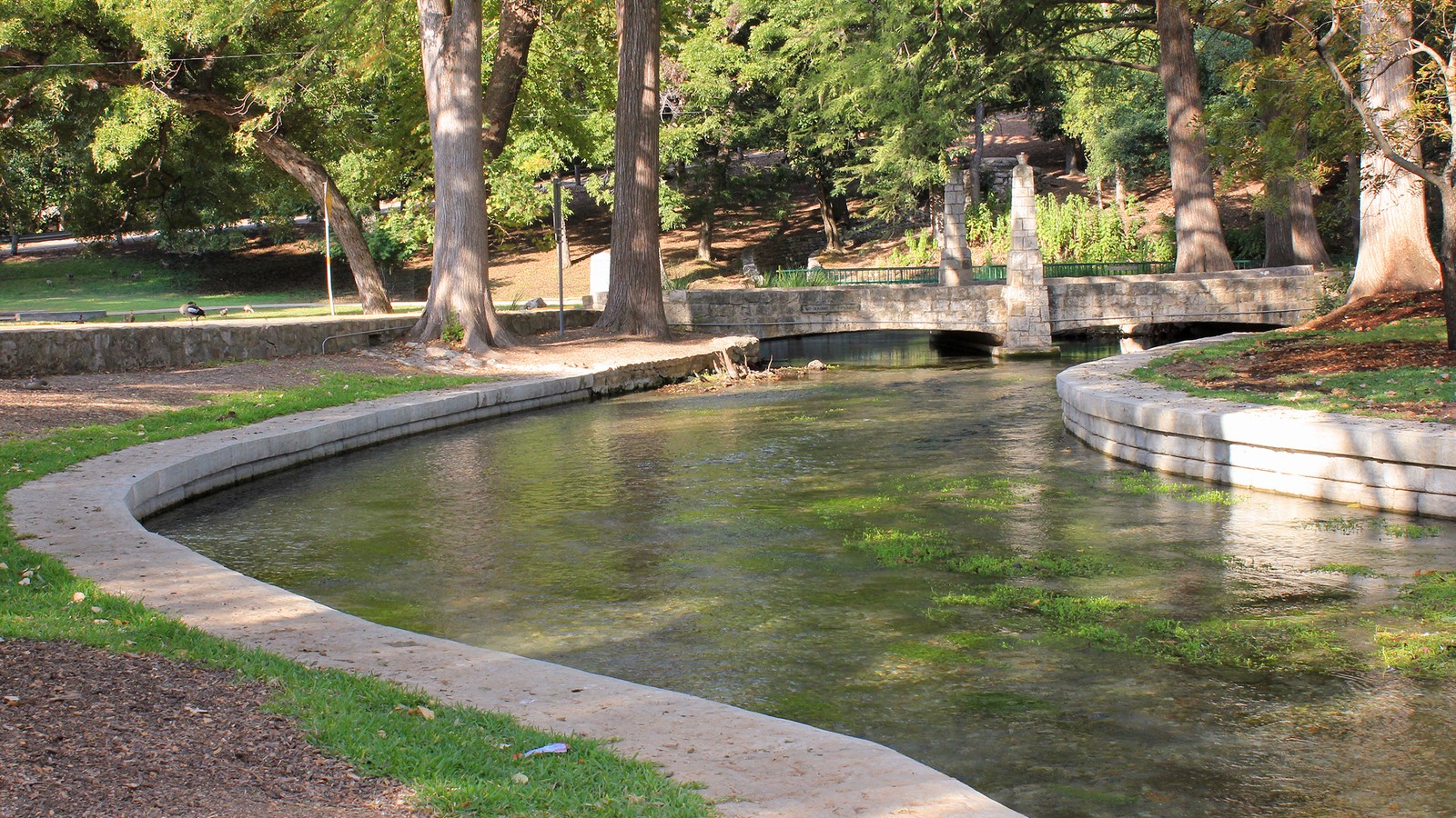
Landa Park sits northwest of downtown along the Comal River. The city describes it as a 51-acre park with walking routes and a range of recreational facilities. Nearby properties can offer quick access to the park, downtown, and river areas, but river proximity is not a substitute for a flood-zone and drainage review.
The West End, west of downtown around the West San Antonio Street and Spur Street corridors, has its own city planning work. Buyers should not treat every property west of Main Plaza as part of one uniform downtown market. Street conditions, housing age, current land use, and nearby redevelopment vary block by block.
South Castell Avenue is another area to watch. The city has planned public and private redevelopment concepts around the civic and convention center area. Anyone buying nearby should verify what is funded, approved, proposed, or already under construction rather than relying on a rendering.
Gruene, Hunter Road, and the north-central river area
Gruene is a historic district and visitor destination near the Guadalupe River. It is commonly grouped with New Braunfels, but its housing, commercial activity, river access, traffic, and short-term-rental questions differ from downtown.
Hunter Road connects Gruene with central and northwest New Braunfels. Properties in this area range from established homes to newer development and commercial uses. The river, topography, visitor traffic, and access to Loop 337 or I-35 can all affect the day-to-day experience.
A Gruene-area search should include:
- the property's actual distance and route to the river
- floodplain and drainage information
- city zoning and any applicable historic requirements
- short-term-rental rules and nearby lodging activity
- weekend and seasonal traffic
- the age and condition of private systems, retaining walls, drainage features, and foundations
Gruene deserves its own guide because a citywide median says little about a small historic area with an unusual mix of homes and commercial activity.
East of I-35: Creekside, Freiheit, FM 1101, and Mayfair
East and northeast New Braunfels contain much of the city's newer residential and commercial growth. Creekside and the Freiheit Road area place many homes near I-35 access, retail, medical uses, entertainment, and new development. Goodwin Lane and FM 1101 connect additional subdivisions and undeveloped tracts to this side of the city.
Mayfair is a large mixed-use development northeast of the established core. Its own materials describe plans for homes, employment space, commercial areas, public parks, trails, and an on-site Comal ISD elementary school. Buyers should separate completed amenities from long-range plans and confirm the current builder, phase, tax entities, HOA documents, and utility arrangements for the lot under consideration.
The east side can be practical for I-35 access, but the closest interchange is only one part of the commute. Buyers should test the full route during the hours they will use it, including the neighborhood street, frontage road, intersection, and final destination.
New construction is common in this broader area. Compare the builder's base price with the delivered price, lot premium, incentives, tax estimate, HOA dues, insurance quote, inspection findings, and nearby resale inventory. A low advertised payment or temporary rate incentive does not show the full ownership cost.
West and northwest of Loop 337: Veramendi and SH 46 growth
West and northwest New Braunfels transition from established neighborhoods into newer master-planned development and Hill Country terrain. Veramendi is a large mixed-use project west of Loop 337. The City of New Braunfels describes it as roughly 2,400 acres with residential and commercial development plus parks and recreational areas.
This side of the city can differ sharply from the flatter I-35 corridor. Elevation changes, rock, drainage paths, retaining walls, foundation design, landscaping costs, and wildfire exposure can deserve closer review. A view lot and a level interior lot in the same community may have different maintenance and resale considerations.
SH 46 is an important east-west route. Loop 337, SH 46, Oak Run Parkway, and connecting roads can become the practical commute map for residents on this side. Buyers should check current construction and planned road work through the city and TxDOT before judging a route from a map app on one quiet afternoon.
Veramendi will receive a separate guide because builder sections, schools, amenities, future phases, and resale competition require more detail than a citywide summary can provide.
South and southeast New Braunfels: County Line, Walnut, Morningside, and Klein Road
South and southeast New Braunfels include established subdivisions, apartments, newer construction, schools, neighborhood commercial areas, and undeveloped land. County Line Road and Walnut Avenue connect many neighborhoods to I-35 and the central city. Morningside Drive and Klein Road serve additional residential growth farther south and southeast.
The housing mix and road pattern change quickly across this part of New Braunfels. One subdivision may be established and largely built out. Another may be competing directly with new builder inventory. That difference can affect seller concessions, days on market, and the upgrades buyers expect.
This area also crosses school and utility questions that cannot be answered from a New Braunfels mailing address. New Braunfels ISD approved new elementary attendance zones for the 2025-2026 school year after opening Legend Point Elementary, relocating Lamar Elementary, and preparing a new use for County Line Elementary. Comal ISD publishes separate attendance maps for its campuses. Buyers should use each district's current address lookup and then confirm the result with the district.
New Braunfels addresses outside city limits
The 78130 and 78132 ZIP codes extend beyond a simple city-center boundary. Some New Braunfels addresses are outside city limits or near the edge of the city's extraterritorial jurisdiction. Others are in master-planned communities, acreage subdivisions, or rural areas that people casually describe as New Braunfels.
Outside-city properties can introduce questions about:
- county rather than city development rules
- a municipal utility district, water control and improvement district, or other special district
- electric, water, and wastewater service territories
- wells, septic systems, propane, and private roads
- fire and emergency-service districts
- deed restrictions and property-owner associations
- road maintenance
- floodplain, drainage, and wildfire exposure
A larger lot does not automatically mean fewer restrictions or lower costs. Parcel records, plats, title documents, utility confirmations, tax certificates, and insurance quotes provide the answer.
What the 2026 housing numbers do and do not say
Redfin reported a roughly $340,000 median New Braunfels sale price for the three months shown when this report was prepared, down 1.5 percent from the comparable period a year earlier. Its reported median price per square foot was $173. This is a rolling commercial-market snapshot, not a complete MLS analysis and not a value estimate for a particular home.
The number is most useful as a reminder that the broad city market is no longer one-way. Buyers still need to compare condition, location, taxes, builder competition, and seller terms. Sellers need to compare with homes that a buyer would genuinely consider instead of relying on a citywide median.
ZIP-code data also show why one New Braunfels number can mislead. The 78130 market contains much of the central city and a large volume of production housing. The 78132 market includes a different mix of Hill Country, acreage, and higher-priced properties. Their medians can move independently because the homes sold in each period are not the same type of inventory.
Velvet Realty Group can prepare a current MLS comparison for a specific neighborhood, subdivision, ZIP code, or property type. Any public citywide figure should be dated and labeled by source.
Property taxes require the full entity stack
The City of New Braunfels lists a 2025 city property-tax rate of $0.408936 per $100 of taxable value. That is only the city component. A property's total bill can also include a county, school district, emergency-services district, community college district, and special district.
The total rate is not enough by itself. Buyers should review:
- the current appraised value and exemptions
- every taxing entity on the parcel
- whether a homestead exemption is already reflected
- any MUD, WCID, or other district debt component
- the lender's projected escrow amount
- the possibility that a new-construction home was previously assessed as vacant land
For new construction, use an estimate based on the completed home's expected value rather than the builder's land-only tax history.
Utilities are not uniform at the edge
New Braunfels Utilities is the city's municipally owned electric, water, and wastewater provider. NBU also publishes an infrastructure-information portal showing general locations of electric, water, wastewater, and hydrant assets.
That does not mean every New Braunfels address receives every service from NBU. Utility territories can change near the city edge, and a parcel may have electricity from one provider, water from another, and an on-site septic system. Confirm each service directly before relying on a listing description.
For an older central property, ask about water and sewer line material, electrical service, drainage, and prior repairs. For acreage or an edge property, verify well records, septic permits and maintenance, propane, internet options, and any extension or connection costs.
Schools: verify the address, not the neighborhood name
New Braunfels is served by both New Braunfels ISD and Comal ISD. District boundaries do not follow ZIP codes, subdivision marketing names, or a simple east-west line.
NBISD changed elementary attendance zones for the 2025-2026 school year. Comal ISD also publishes current elementary, middle, and high-school attendance boundaries. Future growth can lead to additional changes.
Velvet Realty Group does not rank schools or steer buyers toward or away from an area based on protected characteristics. Buyers can review district resources, Texas Education Agency data, programs, transportation, and current attendance boundaries, then confirm the assigned campuses directly with the district before making a decision.
Flood, drainage, and river checks
The Comal and Guadalupe Rivers are central to New Braunfels, but flood risk is not limited to riverfront property. Creeks, low-water crossings, drainage channels, topography, impervious development, and localized runoff can matter elsewhere.
The City of New Braunfels provides floodplain-management information, and FEMA maps remain an important starting point. A complete property review should also include:
- the current FEMA flood designation
- city or county drainage information
- the survey and elevation information when relevant
- visible drainage paths and retaining structures
- seller disclosures and insurance claims
- a property-specific flood-insurance quote
- road access during heavy rain
A property outside a mapped high-risk flood zone can still have drainage problems. A property in or near a mapped zone may require additional insurance, elevation, lending, or improvement review.
Roads, construction, and public transportation
I-35 carries regional traffic through New Braunfels. Loop 337, SH 46, FM 306, FM 1101, County Line Road, Walnut Avenue, Common Street, and Klein Road shape many local trips.
The city states that its 2023 bond program is investing more than $99 million in roadway improvements, including work associated with Barbarosa Road, Kohlenberg Road, and Common Street. Project status can change, so buyers should confirm whether a nearby improvement is proposed, designed, funded, under construction, or complete.
New Braunfels also operates Rio, an on-demand microtransit service. The city lists a $4 general one-way fare beginning January 1, 2026, with a $2 fare for qualifying seniors, veterans, students, and riders with disabilities. Service boundaries, hours, and fares should be checked before relying on it for a regular trip.
The Census Bureau's 27.1-minute mean travel time to work is a citywide average for 2020 through 2024. It does not predict a commute to downtown San Antonio, Austin, JBSA-Randolph, or a specific employer. Test the actual route in both directions during the expected travel window.
Parks, rivers, and day-to-day recreation
The city reports 41 local parks. Its two large municipal anchors are the 51-acre Landa Park and 62-acre Fischer Park. Cypress Bend Park provides Guadalupe River access, while smaller neighborhood parks serve other parts of the city.
Park access can be a meaningful property feature, but check the real route. A home that appears close on a map may lack a direct sidewalk or safe crossing. River access, parking rules, seasonal restrictions, event traffic, and park hours also change the practical value of proximity.
Development worth watching
The most important projects are not all in one part of New Braunfels:
- The city is updating its comprehensive plan after adding more than 30,000 residents since the 2018 plan.
- More than $99 million from the 2023 bond program is directed to roadway improvements.
- Veramendi continues to expand west of Loop 337.
- Mayfair is adding homes and mixed-use development northeast of the established core.
- South Castell Avenue and other downtown projects may change land use, public space, and traffic near the center.
- The city has acquired a new 130-acre park and is planning additional library and public-safety capacity.
A future project can improve access or add amenities, but it can also bring construction, traffic, assessments, or new competition. Verify the stage and source before assigning value to it.
How to compare two New Braunfels homes
Use the same checklist for both properties:
- Confirm city limits, county, school district, and every taxing entity.
- Confirm electric, water, wastewater or septic, trash, internet, and emergency-service providers.
- Review flood maps, drainage, topography, road access, and an insurance quote.
- Compare the full monthly cost, including taxes, HOA dues, district charges, insurance, and utility expectations.
- Drive the weekday routes that matter.
- Compare the home with both resale and builder inventory that serves the same buyer.
- Review current and planned roads, commercial development, schools, parks, and adjacent land use.
- Inspect the property based on its age, terrain, systems, and construction type.
The broad area narrows the search. The parcel determines the actual ownership experience.
Buyers can also review the New Braunfels relocation guide and the New Braunfels, Schertz, and Cibolo new-construction guide. For a property-specific comparison, contact Velvet Realty Group with the addresses, commute destinations, and ownership priorities.
Questions about moving to New Braunfels
Is all of New Braunfels inside Comal County?
No. New Braunfels is the Comal County seat, but the city also extends into Guadalupe County. County, school, tax, and service boundaries must be checked for the individual property.
Are Loop 337 and I-35 official neighborhood boundaries?
No. They create a useful orientation ring around central New Braunfels, but they are not legal neighborhood boundaries. City limits, plats, zoning, school districts, and utility territories control the details.
Which part of New Braunfels is downtown?
Downtown generally centers on Main Plaza and the surrounding historic street network. Landa Park, the West End, South Castell Avenue, and Gruene are nearby but have distinct housing and planning considerations.
Is 78130 or 78132 the better ZIP code?
A ZIP code is too broad to answer that question. The two areas contain different housing, terrain, city-limit, utility, tax, and commute conditions. Compare the exact property and routine rather than choosing from a ZIP-code median.
Does every New Braunfels home use New Braunfels Utilities?
No. NBU is the city's municipally owned utility, but service territories vary, especially near city limits and in outlying areas. Confirm electricity, water, wastewater or septic, and any connection costs directly.
Is every New Braunfels address in New Braunfels ISD?
No. New Braunfels addresses can fall in New Braunfels ISD or Comal ISD. Attendance zones can change, so use the current district lookup and confirm the result directly with the district.
What should river-area buyers check?
Review FEMA and local flood information, drainage, elevation when relevant, insurance, road access during heavy rain, property condition, river-use rules, and nearby visitor or short-term-rental activity.
Compare exact New Braunfels properties
A citywide guide can narrow the search, but an address determines the taxes, services, flood review, school assignment, construction competition, and daily routes. Velvet Realty Group can prepare an MLS comparison and property checklist for the homes or neighborhoods under consideration.
This report is general real estate information, not legal, tax, engineering, insurance, financial, or lending advice.
Sources and review notes
Sources reviewed August 2, 2026. Current projects, boundaries, school zones, market figures, fares, and tax rates can change. Recheck the original source and the exact property before relying on a current detail.
- U.S. Census Bureau QuickFacts, New Braunfels city, Texas: population, housing, veteran, commute, and household estimates
- City of New Braunfels City Limits and ETJ map: municipal-boundary and mapping context
- City of New Braunfels comprehensive planning: current comprehensive-plan update
- City of New Braunfels April 2026 growth report: bond, transportation, park, library, tourism, and growth-management updates
- City of New Braunfels tax information: 2025 city property-tax component
- City of New Braunfels floodplain management: local floodplain and mapping resources
- City of New Braunfels developments and projects: Veramendi and other city-tracked development
- City of New Braunfels downtown and South Castell Avenue planning resources
- City of New Braunfels Ride the Rio: microtransit fares and service information
- New Braunfels ISD attendance-zone resources
- Comal ISD attendance-boundary resources
- New Braunfels Utilities infrastructure information portal
- Texas Department of Transportation New Braunfels project resources
- Redfin New Braunfels housing-market page: rolling median sale price and price-per-square-foot snapshot
Photo: Comal River in Landa Park by Larry D. Moore, CC BY 4.0, via Wikimedia Commons. Cropped for web display.
New Braunfels Property Questions?
Compare the exact homes, taxes, services, risks, and routes.